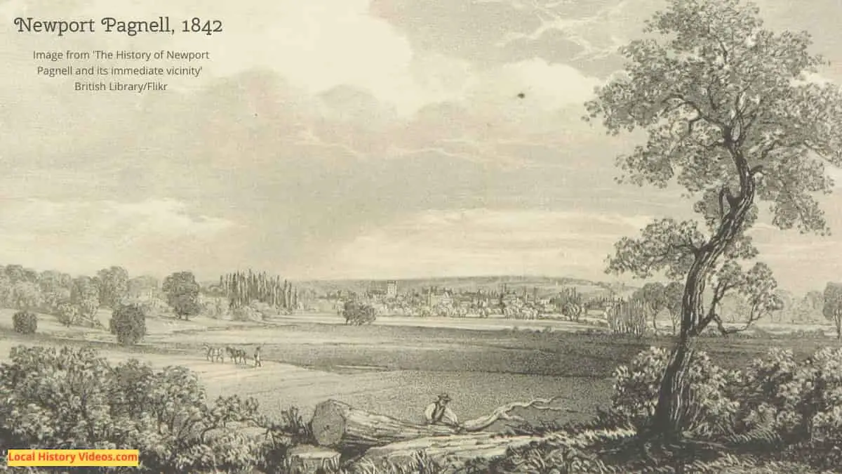
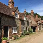
Glimpse history through old images of Newport Pagnell, Buckinghamshire, England.
High Street Demolition
An old cine film gives us a glimpse of the high street as a significant demolition project was underway.
Newport Pagnell – High Street – livingarchiveproject on YouTube
Fancy Dress
The Newport Pagnell Carnival was founded in 1961.
Presumably this old home cine film, showing people gathered in Priory Street, captured one of the community’s gatherings before the carnival was created, since the title card makes no mention of it and the people seem to be dressed in clothing from around the second world war era.
Near the end of the clip, there’s a couple of nice shots of a row of houses behind the dancers.
Newport Pagnell – Priory Street – Fancy Dress and having fun – livingarchiveproject on YouTube
Flooding (1998)
A hoem video captures some of the local flooding suffered on 10th April 1998.
Newport Pagnell Floods – Easter 1998 – Nick Read on YouTube
A bit of Newport Pagnell history
Extract from: The History and Antiquities of the County of Buckingham – Volume 4, by George Lipscomb
Published in 1847
Pages 270 – 271
NEWPORT PAGNELL is situated nearly in the centre of the Hundred to which it belongs, the Town being one of the most considerable in size, and in the extent of its population, in the County.
It is ecclesiastically the head of a Rural Deanery, the site of a very ancient Castle, a Market – Town of great note, and on the course of the River Ouse, one of its principal streams, over which it has two Bridges; one, of modern design and highly ornamental, being constructed of cast – iron, at the southern entrance into the Town from London; the other, an old stone – bridge, with a low parapet, on the Great North – Western Road, leading to Sherrington, Olucy, and the County of Northampton.
This Town is fifty miles distant from London, five miles from Olney, six miles from Stoney – Stratford, six miles from Fenny – Stratford, fourteen miles from Buckingham, nine miles from Woburn, and thirteen miles from Bedford.
The Parish is bounded, on the North, by Gayhurst, Tyringham, and Lathbury; on the East, by the latter, and Crawley; on the South, by Moulsoe and Willen; and on the West, by Great and Little Linford. It is partly intersected by a branch of the Grand Junction Canal.
The old Topographers have given various accounts respecting the precise situation of Newport. Baxter was inclined to place the Lactodorum of the Romans here, ” Nova Porta Paganelli hodiernum est Lactodorum. ” In Salmon’s Survey of England, in 1728, he supposes the name, Nova Porta, to countenance the notion of a military way, very commonly known throughout this part of the country by the appellation of The Port – Way: but which the Bishop of Cloyne is disposed to ridicule as a dream of Salmon; and fixes Lactodorum at Towcester, in Northamptonshire, instead of Newport, as better accordant with the distances laid down in the Itinerary of Antoninus.
It is clear, that the Roman Akeman Street passed through Newport from Stoney – Stratford and Stanton – Barry to Bedford; and the name of Port – Field has been conjectured to belong to contiguous land, which had some relation to this ancient way, called Port – Way. It is also a traditionary report, that Newport was one of the towns which suffered, in 1010, from the predatory incursions of the Danes, when Buckingham, and many other places, especially towards the verge of the County of Oxford, were burnt and destroyed by the ravages of those assailants in their predatory advances towards Bodford.
The road from Newport Pagnell is, in some parts, a dead flat, with hedge – rows on each side; in other parts, quite open, the ascents frequent, but gentle: sometimes a distant scene opens, to enliven the foreground, though without presenting any striking instance of a beautiful landscape.
A slight shock of an earthquake was felt at Newport in November 1795. It was generally observed by all the inhabitants; but the Neptune public – house was agitated in a particular manner, the bells there being made to jingle, and a great alarm excited, but happily without injury to persons or property.
In September 1797, the floods in the neighbourhood of Newport Pagnell exceeded any before known there; and, besides the destruction of several persons by drowning, occasioned the loss of many animals and much farm – produce. All the houses near the River were inundated; many families confined to the upper chambers; all intercourse between different parts of the town confined to the use of boats; and, during fourteen hours, no person could pass into or out of the town by any other conveyance.
From the position of Newport on the Maps, and its distance from the Chiltern Hills, it seems quite impossible to refer, without something like ridicule, to the manifest absurdity of the old doggrel lines of the ancient Bard, in which the course of the little rivers, Ouse, or Ousel, and Lovatt, were described as ” coming ambling in, ” and ” entwining themselves, ” as celebrated in the Poly Olbion.
At the Domesday Survey, the Manor is described in the old Hundred of Sigelai, holden by William Fitz – Ausculf, and retained in his own hands; being rated at five hides, nine carucates of pasture; in the demesne, four carucates of land, and four ploughs kept, and five villeins, having five carucates : the Burgesses having six carucates and a half, and five hides, besides other labouring tenants.
There were nine servants, and two mills of forty shillings rent; pasture sufficient for all the plough – teams, and ten shillings rent ; woods for three hundred hogs, and two shillings rent; and formerly four shillings from the farmers of the Manor among the woods; and from all the rest of the occupants annually, rents of one hundred and sixteen shillings and fourpence; altogether, rated at 20L, and valued in King Edward’s time at 24L.
This Manor had been holden by Ulf, a Thane of King Edward.
More about Buckinghamshire
- Old Images of Buckinghamshire, England
- Old Images of Wolverton, Buckinghamshire
- Old Images of Woburn Sands, Buckinghamshire
- Old Images of Princes Risborough, Buckinghamshire
- Old Images of Olney, Buckinghamshire
- Old Images of Newport Pagnell, Buckinghamshire
- Old Images of Chesham, Buckinghamshire
- Old Images of Bletchley, Buckinghamshire
- Old Images of Aylesbury, Buckinghamshire
- Old Images of Amersham, Buckinghamshire
- Milton Keynes: Old Photos & Film
- Old Images of Beaconsfield, Buckinghamshire
- Old Images of Marlow, Buckinghamshire
- High Wycombe History: Old Photos & Film
- Buckinghamshire, England: Local History Resources

