
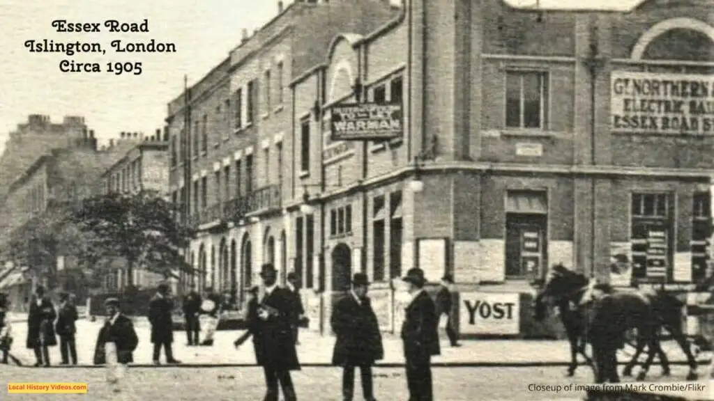
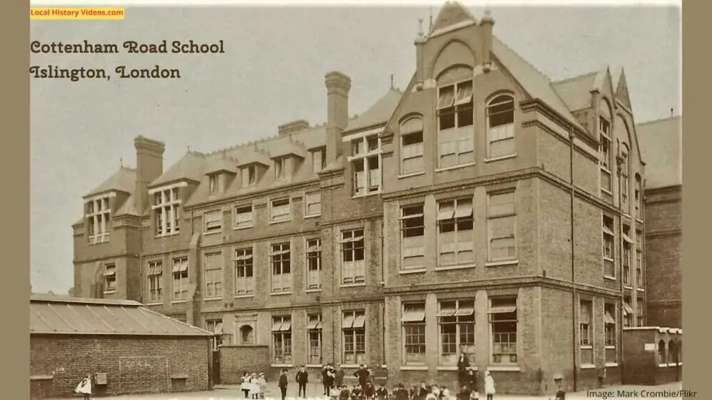
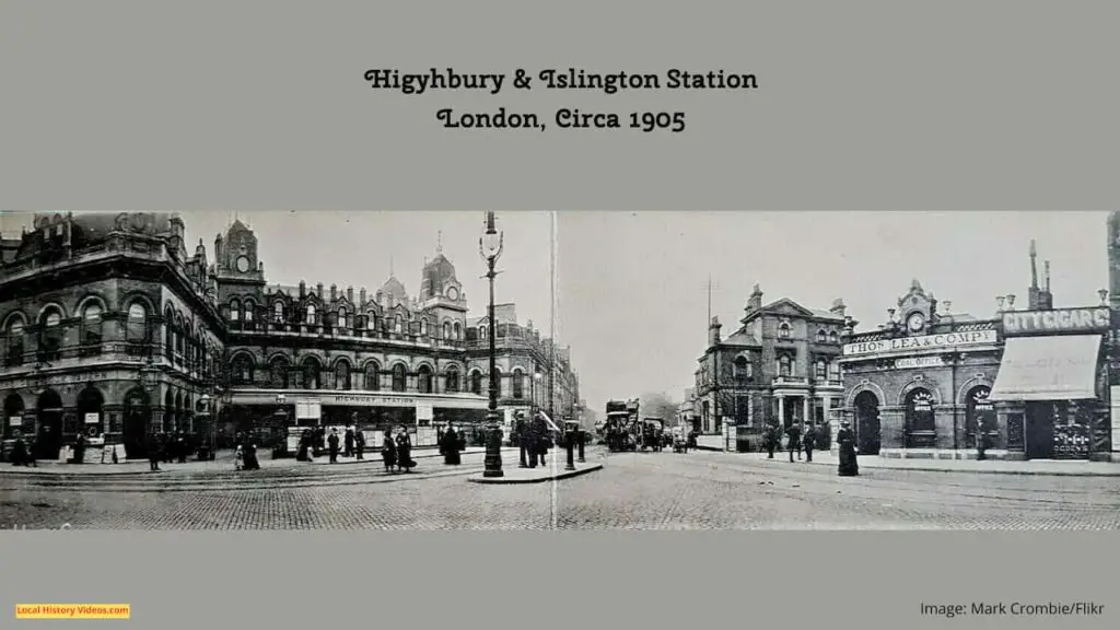
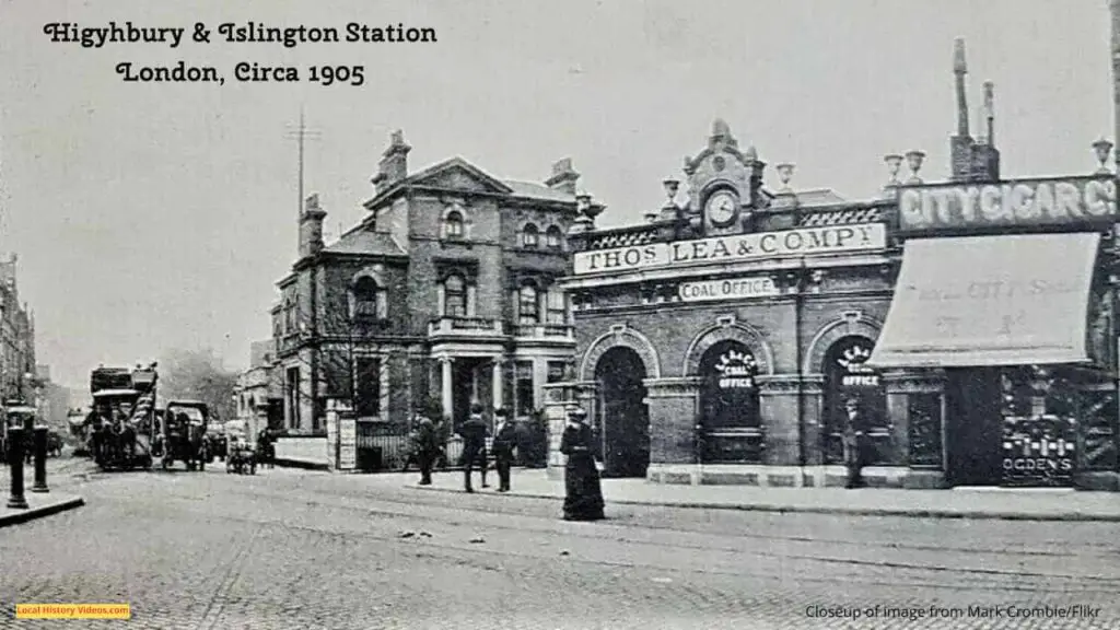
Enjoy a glimpse of history through old images of Islington, in London, England, UK.
Old Pictures of Islington


Old Photos of Islington
North Islington Welfare Centre 1928
In 1928, the Duchess of York opened the new buildings at the North Islington Welfare Centre.
Large crowds of people came out to cheer.
ROYAL: The Duchess of York opens new buildings at North Islington Welfare Centre, London (1928) – British Pathé on YouTube
Rubber Factory Fire 1947
It took 200 firemen and 30 pumps to tackle Islington’s huge blaze, which started in a rubber factory in Caledonian Market.
There was one piece of luck – the wind blew the flames away from the nearby homes in York Way.
Great Rubber Dump Fire In Islington (1947)- British Pathé on YouTube
General Election 1969
Almost a quater of Islington’s community of 45,000 people in 1969 were Irish, and Labour’s election candidate was Irishman Mr Aherne.
At the time, the council had 11,000 people on the housing waiting list, and we later learn that the borough, when combined with Hackney, had 100,000 ‘inadequate’ homes.
The Conservative candidate was 32-year-old building executive Andrew Pearce. it’s funny to see him being driven off in a small car, without putting on a seatbelt.
His election manifesto included a mention of his Irish wife.
He says to the interviewer that about a quarter of the consituency have moved within the past year.
We discover that in 1961, the Milner-Holmes report showed that over 70% of Islington’s families lacked 4 basic amenities: stove, sink, bath, or lavatory.
Austin Williams, an Irish immigrant working in London as a social worker, was standing as an Independent candidate. Actress Diana Hart was his supporter.
Eric Thwaites was the Liberal candidate.
This is not only a record of how the community of Islington was before it went through a lengthy period of astonishing change, but we also see streets of Victorian housing disappearing in favour of brutalist blocks of flats.
North Islington Elections (1969) – British Pathé on YouTube
Islington in 1970
Broadcast on 22nd October 1970, this 2 minute footage shows children playing in Islington’s streets of slum housing.
The journalist tells us the houses were condemned as unfit for human habitation as long ago as 1935.
By 1970, the area was due for demolition, and the council had started buying up houses several years before. The process was both moving very slowly, and making families homeless.
Meanwhile, in the more fashionable streets which were not to be demolished, wealthier people were moving in. They were buying up 2 or 3 subdivided units and combining them into one house, thus reducing the number of homes available in the area.
1970s Poverty | 1970s London | North Islington | Children playing | This Week | 1970 – ThamesTV on YouTube
1970 Housing Problems
Incredibly, by the 1970s many of Islington’s terraced streets of period homes were derelict and unwanted. Those properties still inhabited suffered poor maintenance, but many were simply boarded up.
Gibson Square seemed to be different, with homes and the central garden in good order.
It was an age when very young children could play on the streets unaccompanied.
Outside the terraces, there were plenty of spaces to park.
Barnsbury Street, 27B Canonbury Square (where George Orwell lived), and 8 Canonbury Square (where Samuel Phelps lived) also appear.
Housing Problems (1970-1979)- British Pathé on YouTube
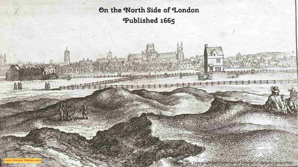
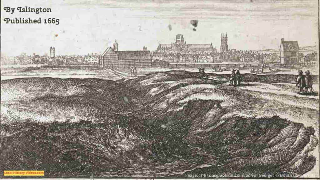
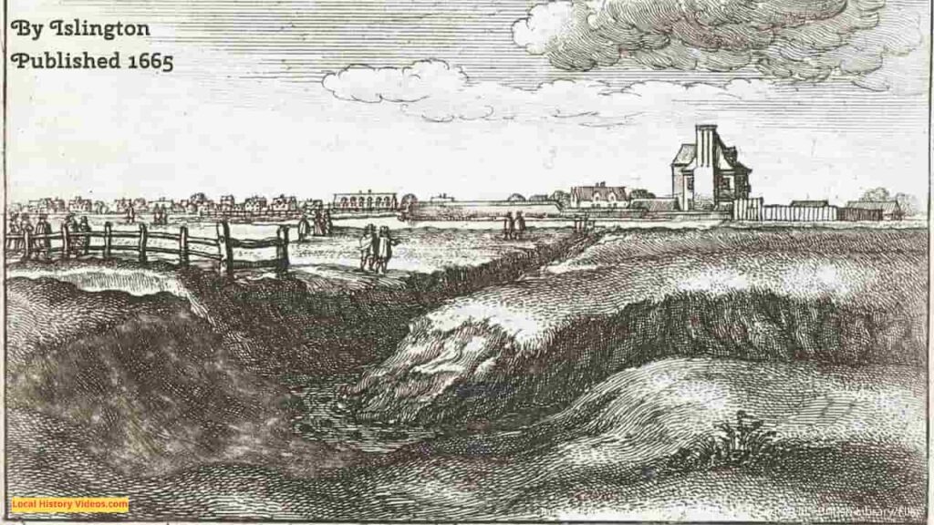
What does the name Islington mean?
The name Islington is a combination of the Saxon name Gīsla, and the old English word dun (hill), meaning Gisla’s hill, developed into Giseldone, Gislandune, and then Isledon. From the 17th century omwards, the area was known as Islington.
A Brief History of Islington
There may have been Roman occupation in the area, since local roads were known as streets in the Middle Ages, but more evidence needs to be found about this.
In 1005, the settlement was called Giseldone.
The settlement was recorded as Gislandune in 1062.
At this time, it was just a small manor.
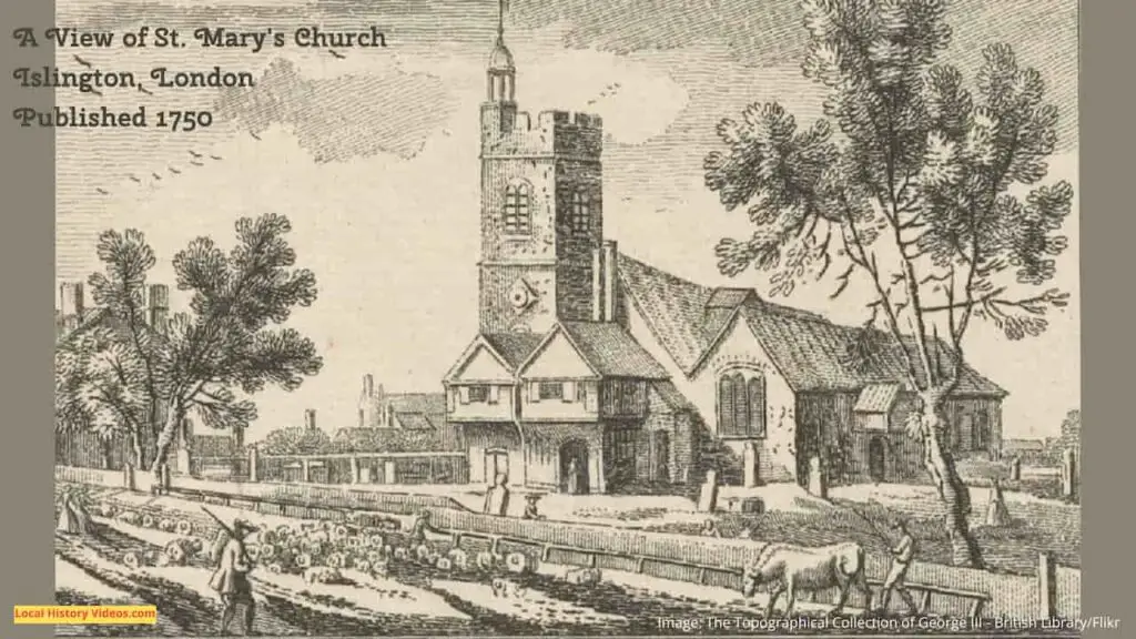
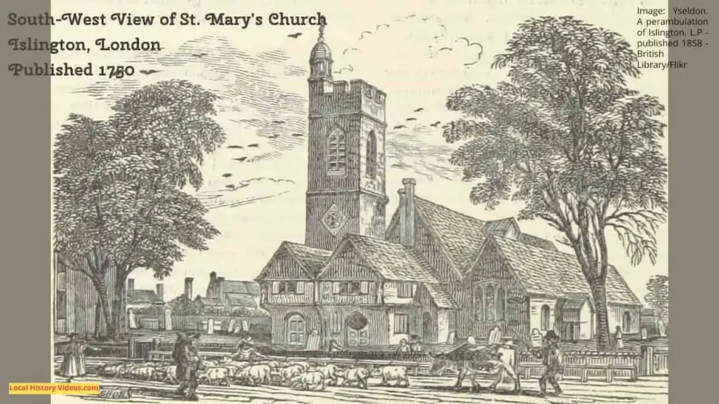
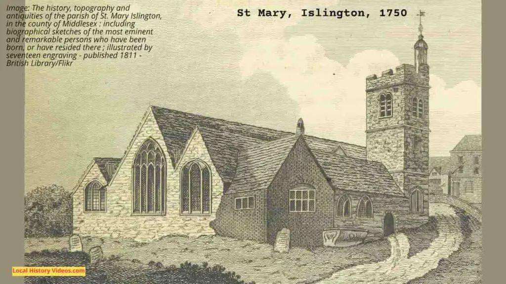
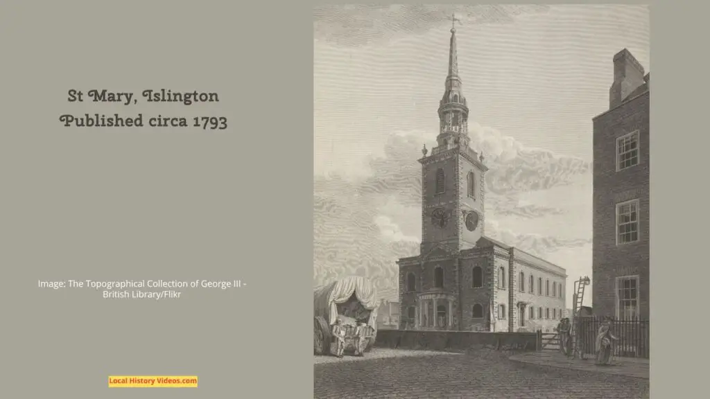
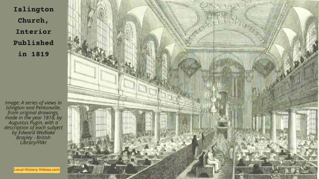
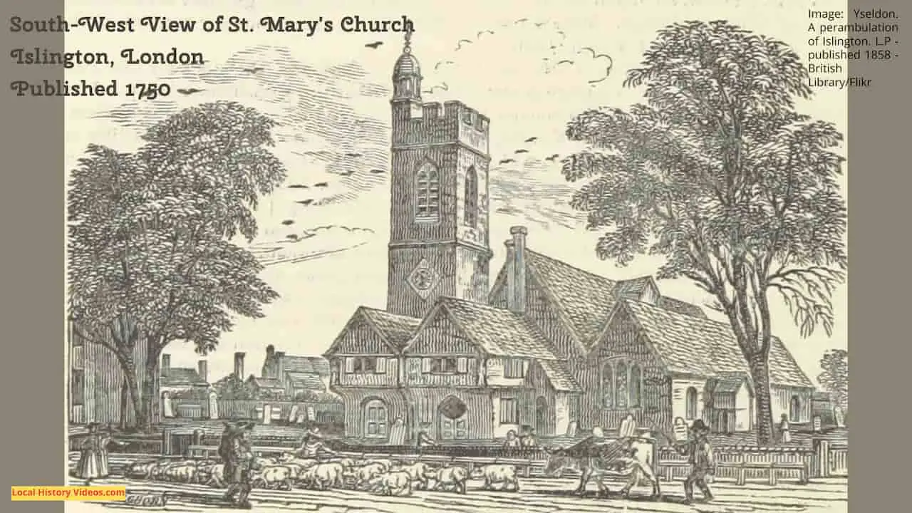
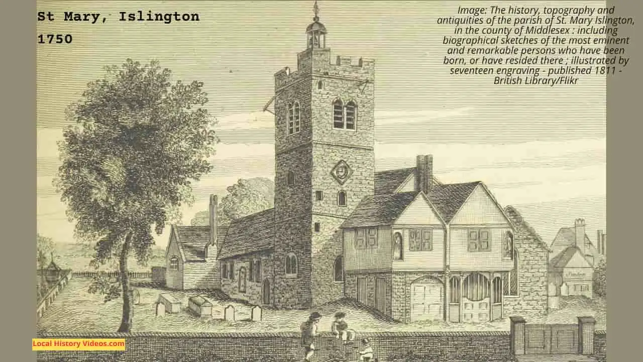
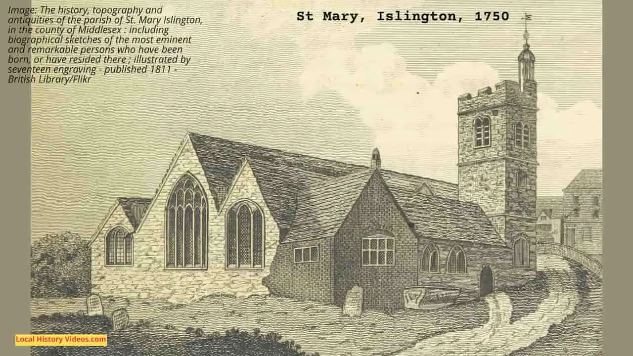
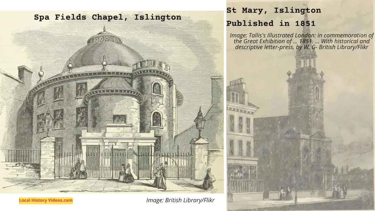
St Mary’s church was built in the 12th century, making it the first church recorded in this community. Today St Mary’s is found on Upper Street.


The estates of the Bishop of London and the Dean and Chapter of St Pauls included Islington.
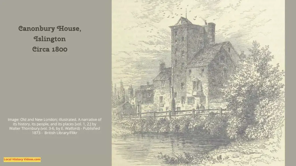
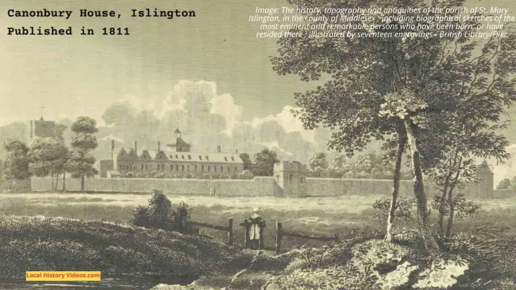
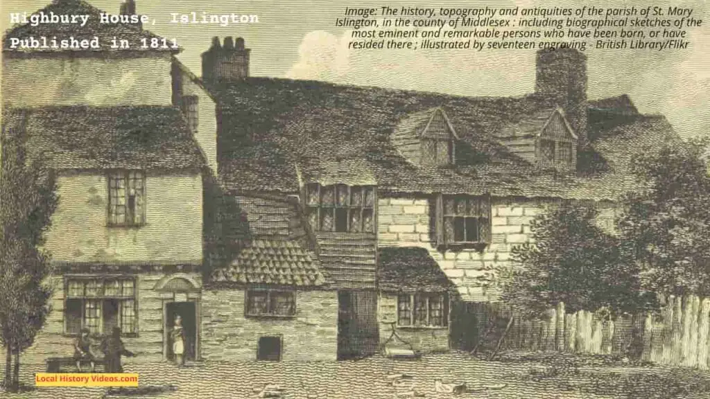
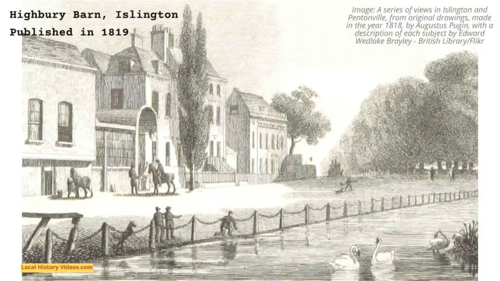
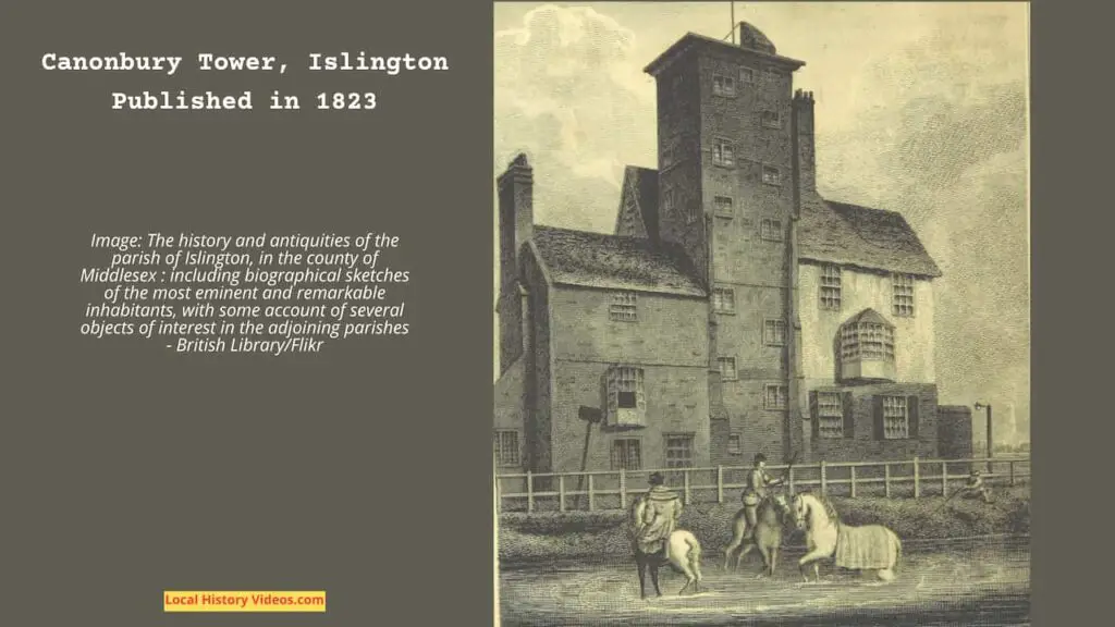
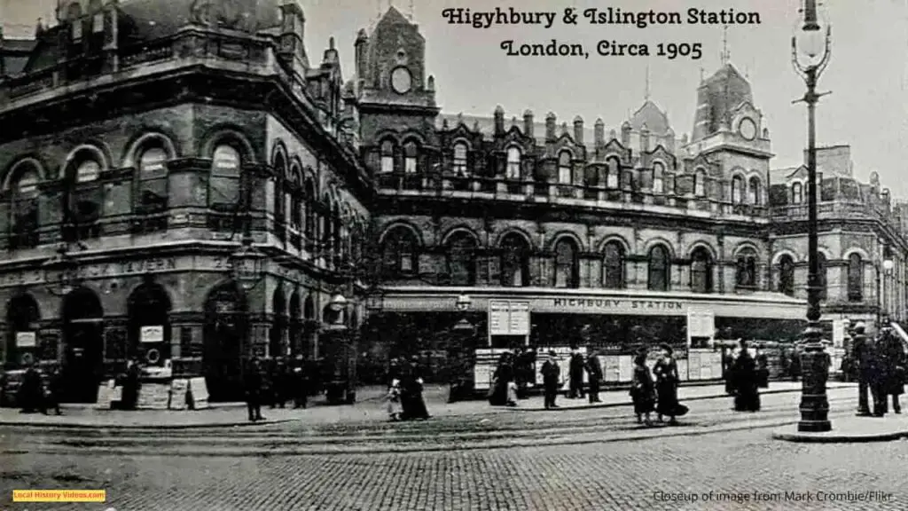
In the 13th and 14th centuries, records also mention the nearby manors of Bernersbury (Barnsbury), Neweton Berewe or Hey-bury (Highbury) and Canonesbury (Canonbury).
Both Highbury and Cannonbury had substantial moated manor houses.
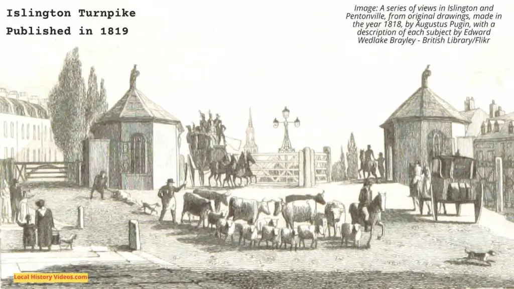
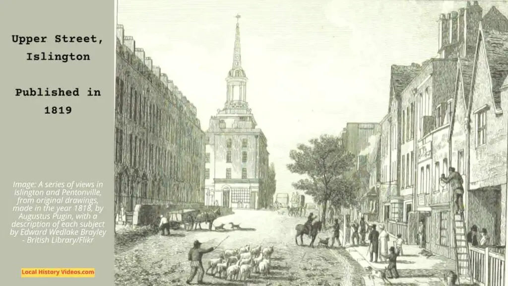
The Great North Road from Aldersgate, connecting with Highgate Hill’s new trunpike, or toll road, appeared in the 14th century. It was roughly where Upper Street rund today, ending with a toll gate at The Angel.
The Liverpool Road we know today was originally the Back Road, a drovers’ road for cattle on their way to Smithfield. It even had pens and sheds for resting the animals.
St Mary’s church was rebuilt in the 15th century.
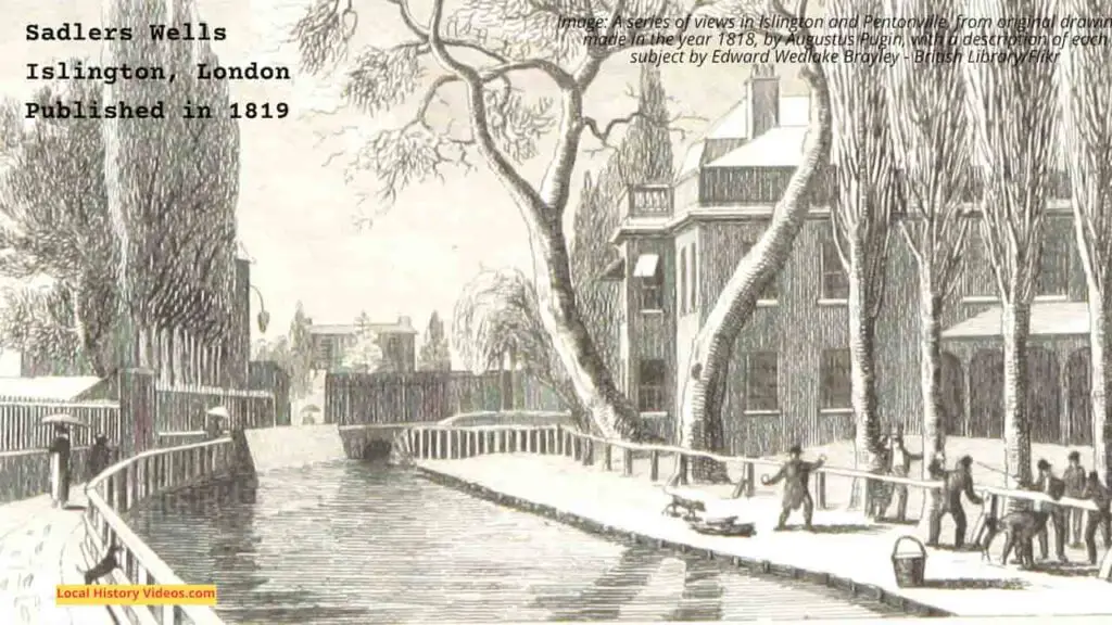
Being close to the City of London and the City of Westminster, yet full of rural charm, in the 16th century Sadler’s Wells and nearby Islington attracted rich and eminent visitors and residents. The businesses to serve them, including taverns and inns who also catered for people travelling in and out of London, also increased in number.
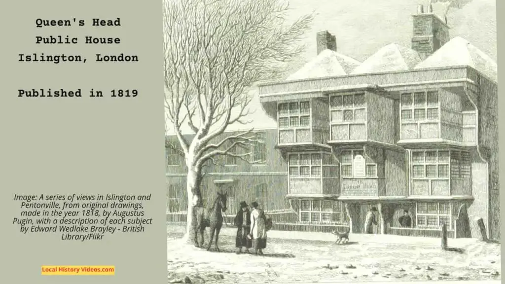
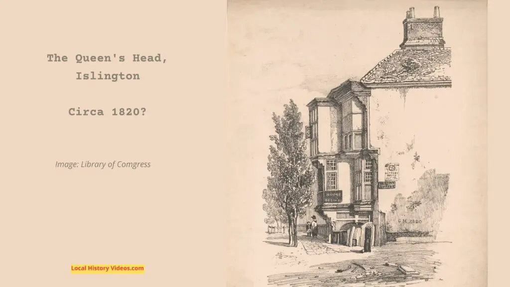
The King’s Head Tavern was built opposite the parish church in 1543. During the Victorian era, it was rebuilt on the same site, and still stands today, well known for the small theatre that runs in the public house.
By 1548, 440 communicants were recorded in Islington. However, many fugitives and recusants found shelter in the local inns.
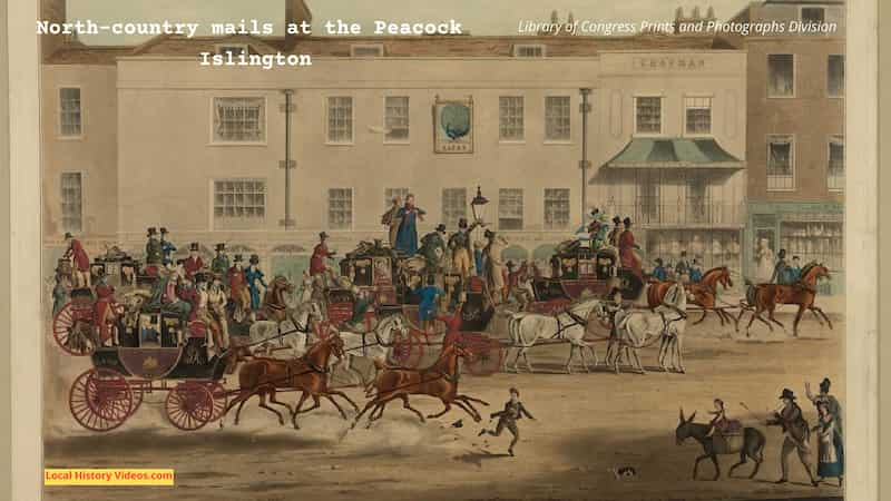
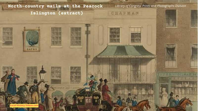
The Peacock Inn was built in 1564.
The Peacock Inn facade you see today was put up in 1857, although the pub closed in 1962. In the novel Tom Brown’s Schooldays, by Thomas Hughes, which was published the same year as the inn’s new facade, Tom Brown stays in the Peacock Inn before he travels to Rugby School.
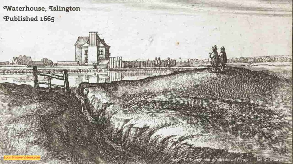
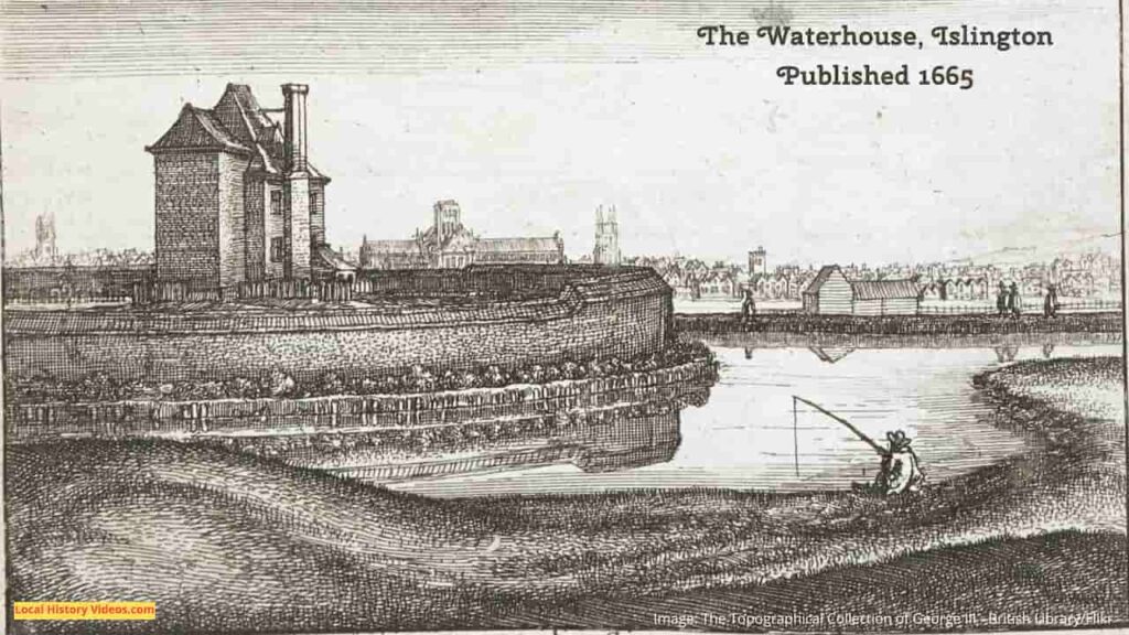
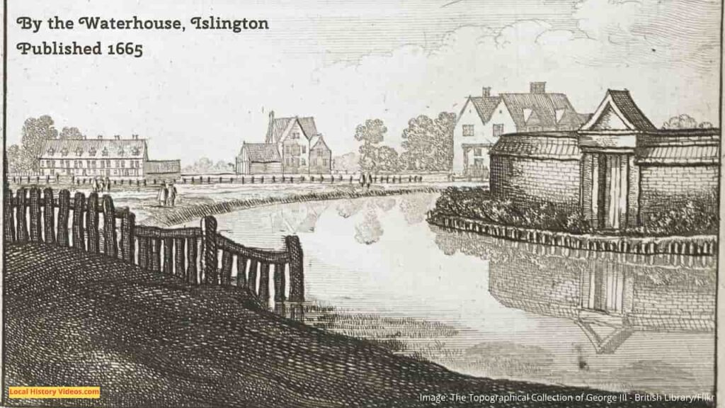
Islington was close to several fresh water springs, including Sadler’s Wells, London Spa and Clerkenwell. Water was drawn into wooden pipes, providing some of London’s water supplies.
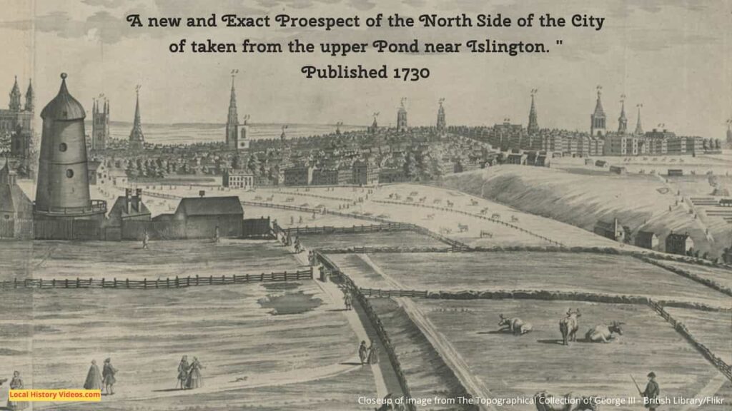
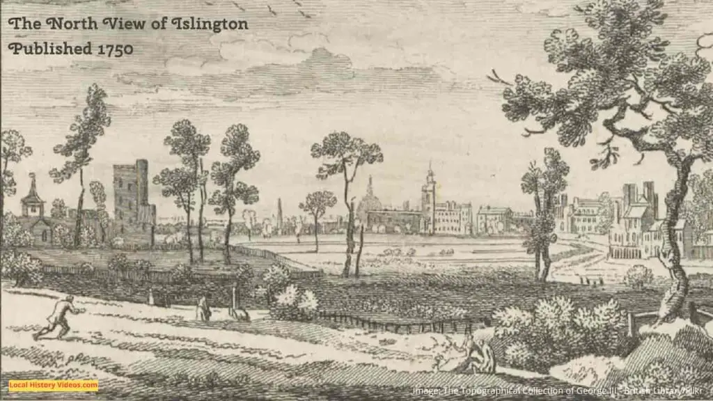
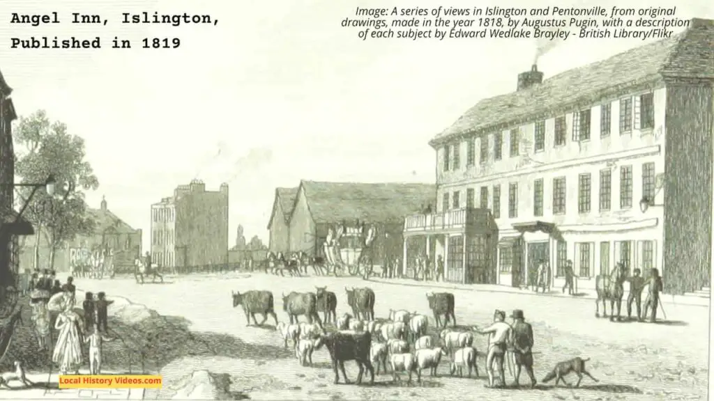
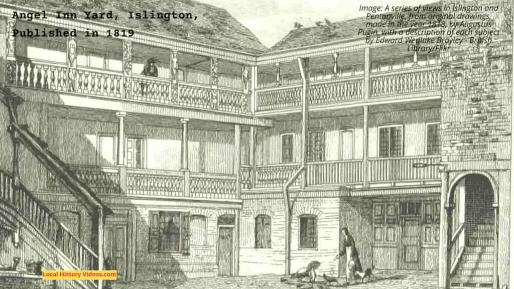
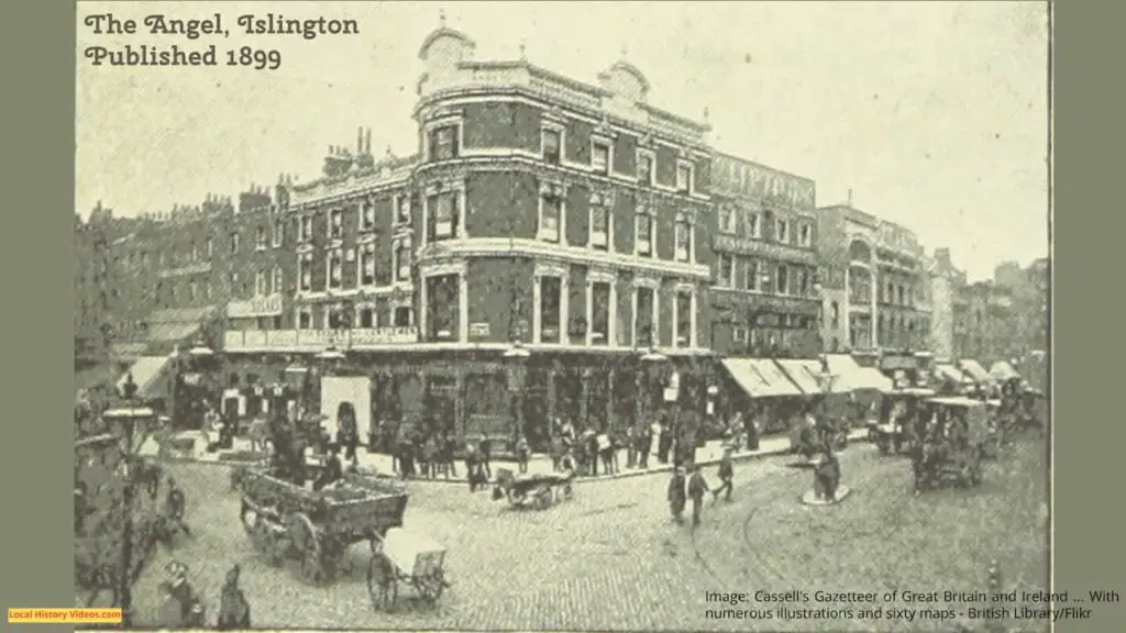
The High Street of the original village of Islington is now known as Islington High Street. When the High Street was first seen on a map, back in 1590, it contained housing, a public pond, and nine inns. One of the inns was called the Angel, after which the area is called The Angel Islington.
In the 17th Century, the name Isledon gave way to Islington, which has remained ever since.
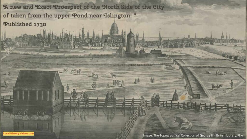
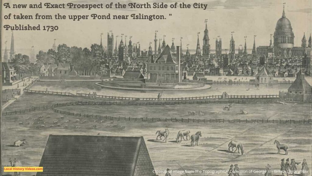
On 29 September 1613, the New River was opened by Sir High Myddelton. It was a waterway which ran from the River Lea in Hertfordshire, to the New Rive Head in Finsbury, at the foot of the hill on which Islington stands. Much of the water course is now covered, but it used to run east of Upper Street.
A statue of Sir High Myddleton stands above a drinking fountain, which no longer works, at Islington Green.
The new waterway was needed for water supplies because the population was growing so rapidly, and demand was outsripping local water sources. The New River now attracted market gardeners, given Islington’s convenient access to the food markets of London.
The Islington Turnpike Trust was formed in 1716, and their control of the High Street soon spread to most major roads in the area, including Caledonian Road, Euston Road, City Road and New North Road.
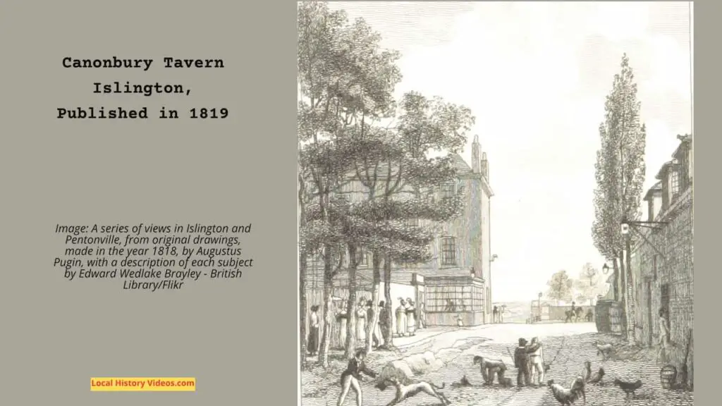
By 1716, Upper Street was home to 56 ale-house keepers! Between them, they offered food and drink, accommodation, tea gardens, archery skittle alleys and bowling, soon followed by music, dancing, billiards, firework displays and even balloon ascents.
Population of Islington in 1801: 10,212
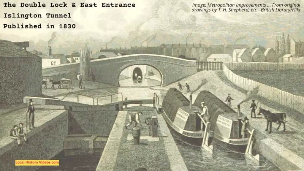
In 1820, the Regent’s Canal was constructed so cargo could access the canal system from Limehouse, which passes though Islington.
This stretch includes a 2,907 foot (886 metre) tunnel, which had no towpath so bargees had to brace themselves on the barge roof and push their legs against the tunnel walls and roof to walk the barge through.
Warehousing and industry dominated the area east of the canal tunnel and north of the City Road. Most have disappeared, while the remainder was converted into residential buildings or small units for businesses mainly in the creative industries.
In 1833, the Islington Literary and Scientific Society was established, wth the aim to spread knowledge through lectures, discussions, and experiments. Held at Mr. Edgeworth’s Academy on Upper Street, the subjects of politics and theology were forbidden.
The Islington Literary and Scientific Society moved to new, commissioned premises in Wellington Street, (later Almeida Street), in 1837. Called the Literary and Scientific Institition, the stuccoed Grecian style building was designed by Roumieu and Gough, and annual membership cost two guineas.
Facilities at the Literary and Scientific Institution included a lecture room for an audience of 500 people, a laboratory, a reading room, and a museum. There was also a library, which two years after opening contained 3,300 volumes on its shelves.
The first horse-drawn omnibuses appeared in the 1830s, and with the increase in accessibility to London came more residents to Islington.
In 1862, William Dixon’s Cattle Layers on Liverpool Road was used as the site for the new Royal Agricultural Hall.
It main purpose was the annual Smithfield Show, held each December. However, with a hall rising 75 feet into the air, an arched glass roof spanning 125 feet, and capacity for up to 50,000 people, it quickly became London’s promary exhibition site.
Islington Green also became a popular area for music halls and theatres in the 19th century.
In 1862, Samuel Thomas Collins Vagg founded an entertainment room in the Landsdowne Tavern. At first it was used by customers who wanted to sing, but then became a venue for professional singers.
The decline of Islington started in the Victorian era, with the working classes moved out of central London, to make way for London’s railways and their associated structures. For the middle classes, the railways offered the chance to move further away from London, and their large houses in Islington were sold off to become subdivided homes for multiple working class families. It would be the 1960s before the area was on the rise again.
In 1872, the library at the Literary and Scientific Institition was sold off. The Wellington Club leased or purchased the Literary and Scientific Institition premises between 1874 and 1886. The year before their occupation ended, the venue was used for concerts, balls, and public meetings.
In 1890, the building formerly known as the Literary and Scientific Institution and the Wellington Club was taken over by the Salvation Army and renamed the Wellington Castle Barracks.
Population of Islington in 1891: 319,143
In 1897, the Landsowne Tavern was replaced by the Collins Music Hall, which had seating for 1,800 audience members, and ten bars.
The council built many social housing blocks for local residents in the 1930s.
During World War II, Islington was hit badly by German bombing raids. About 3,200 homes were destroyed by bombs and incendiary devices.
The Royal Agricultural Hall was requisitioned and put to use as the wartime Mount Pleasant Sorting Office. Since then it has not been used as an exhibition centre but instead had various purposes, including as the Business Design Centre.
In 1955, the Salvation Army left the Wellington Castle Barracks. The building first became a factory and showroom for Beck’s British Carnival Novelties, before eventually becoming an abandoned site.
The Collin’s Music Hall suffered major fire damage in 1958. Over the years it had hosted some of the music hall greats during its years of operation, including Marie Lloyd, George Robey, Harry Lauder, Harry Tate, George Formby, Vesta Tilley, Tommy Trinder, Gracie Fields, Tommy Handley and Norman Wisdom.
But the fire came at a time when the music halls were already closing, and the Collin’s Music Hall never reopened. Instead, one part of the building was redeveloped into a new theatre, accessed from Essex Road, and another part is used as a bookshop.
By the mid-1950s, the Islington area had a reputation for poverty and decay, following a century of decline. The council was in the midst of a huge post-war rehousing development, tearing down old terraces and raising new blocks of flats, with the peak development happening in the 1960s.
Industrial use of the Regent’s Canal declined in the 1960s, which was around the time the middle classes started moving into the area’s Georgian houses, beginning a process of gentrification.
Dan Crawford opened the small theatre in the King’s Head Tavern. He objected to the demilisation of UK currency that took place in February 1971, so for 25 years the King’s Head continued to display the prices in old money.
In 1982 the Almeida Theatre was founded in the building formerly known as the Literary and Scientific Institution, the Wellington Club, and the Wellington Castle Barracks. By then the building had been empty for many years, and fundraising took almost four years, including a public appeal in 1981. It opened during a festival of avant-garde theatre and music, and some of the festival was held at the Almeida.
More Pictures of Old Islington
Old Islington in London, England, enjoyed through historic photos, vintage pictures & archive film. Browse history in these fascinating old images of a bygone era on my Pinterest board at:
https://www.pinterest.co.uk/LocalHistoryVideos/islington-old-photos-pictures
More about London
- Chelsea, London: History in Old Images
 Enjoy a glimpse of history through old images of Chelsea in Greater London, England, UK.
 - Wallington, London: History in Old Images
 Enjoy a glimpse of history through old images of Wallington, in Greater London, England, UK.
 - Bromley, London: History in Old Images
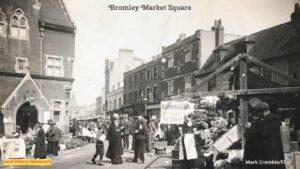 Enjoy a glimpse of history through old images of Bromley, in London, England, UK.
 - Old Images of Wandsworth, London
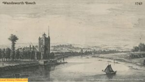 Glimpse history through old images of Wandsworth, London, England, UK.
 - Old Images of Southwark, London
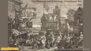 Glimpse history through old images of Southwark, London, England.
 - Old Images of Richmond upon Thames, London
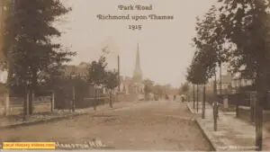 Glimpse history through old images of Richmond upon Thames, London, England, UK.
 - Old Images of Purley, London
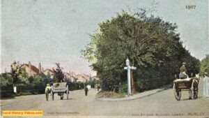 Glimpse history through old images of Purley, London, England, UK.
 - Old Images of Merton, London
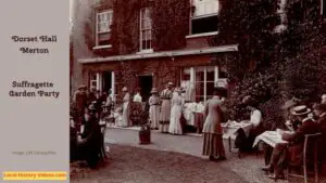 Glimpse history through old images of Merton, London.
 - Old Images of Lewisham, Southeast London
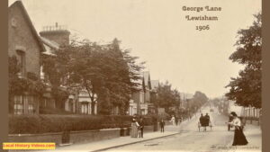 Glimpse history through old images of Lewisham, in Southeast London, England.
 - Old Images of Lambeth, London
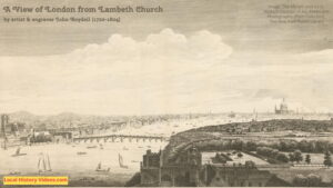 Enjoy a glimpse of history through old images of Lambeth, London, England.