Enjoy a glimpse of history through old images of Bury St Edmunds, an ancient Suffolk town in England, UK.
Old Pictures and Maps of Bury St Edmunds
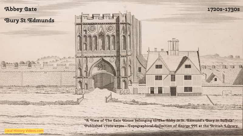
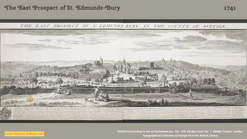
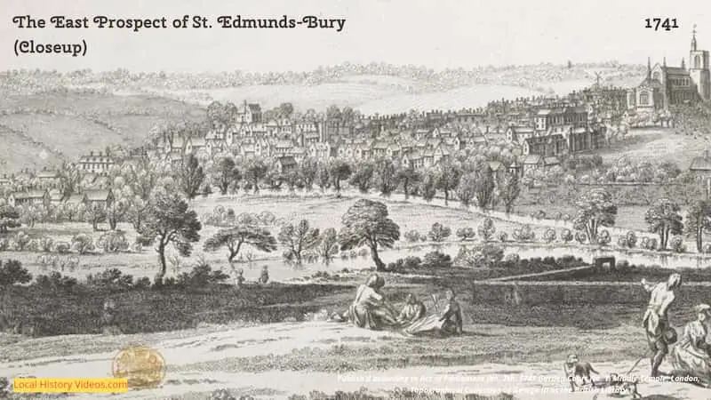
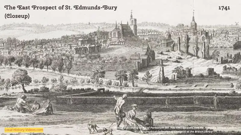
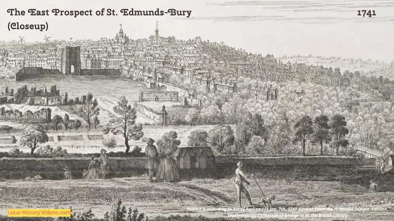
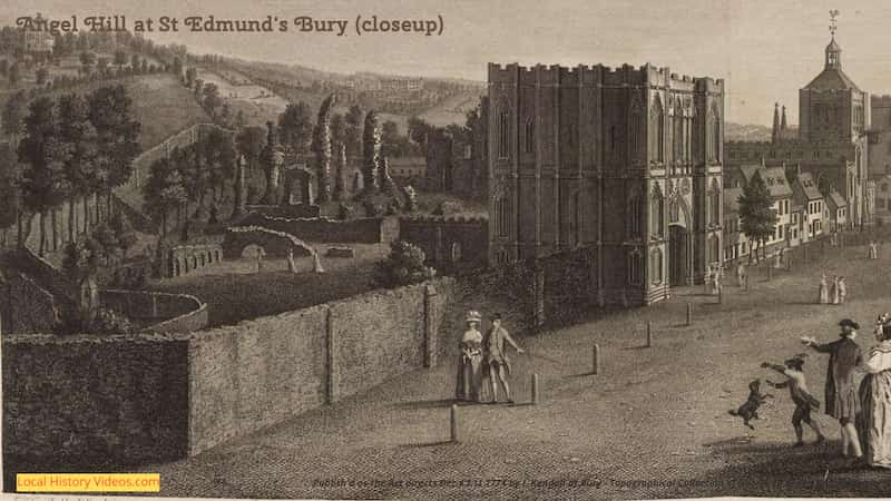
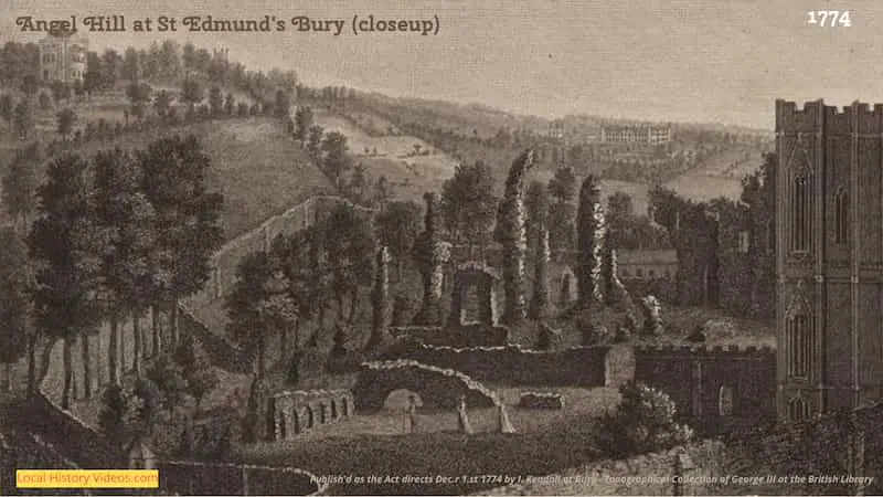
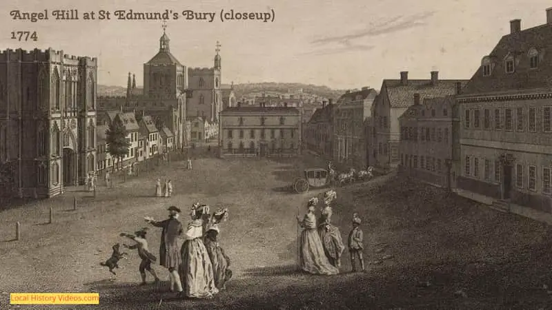
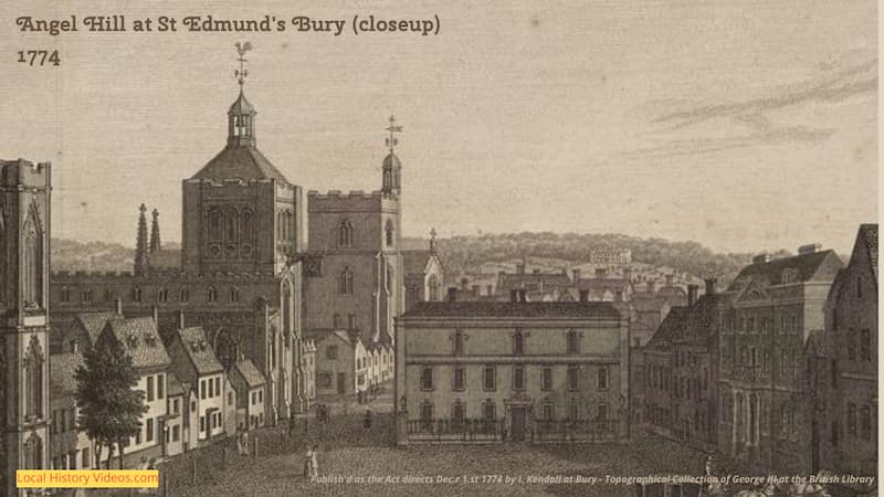
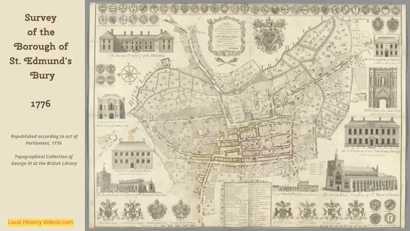
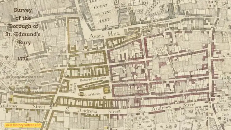
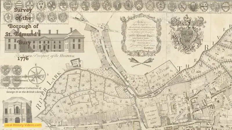
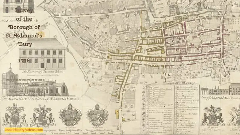
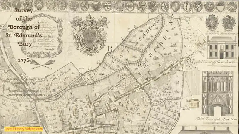
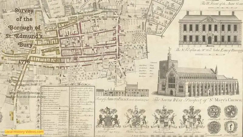
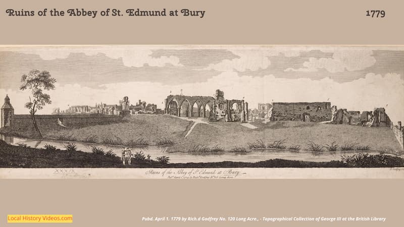
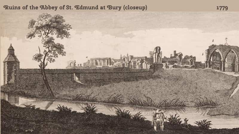
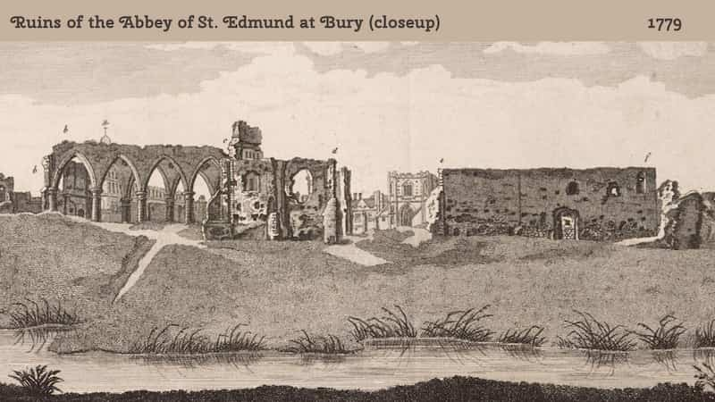
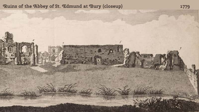
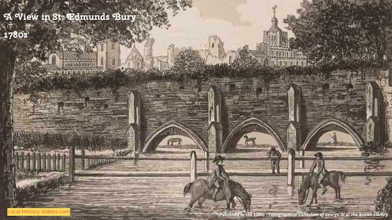
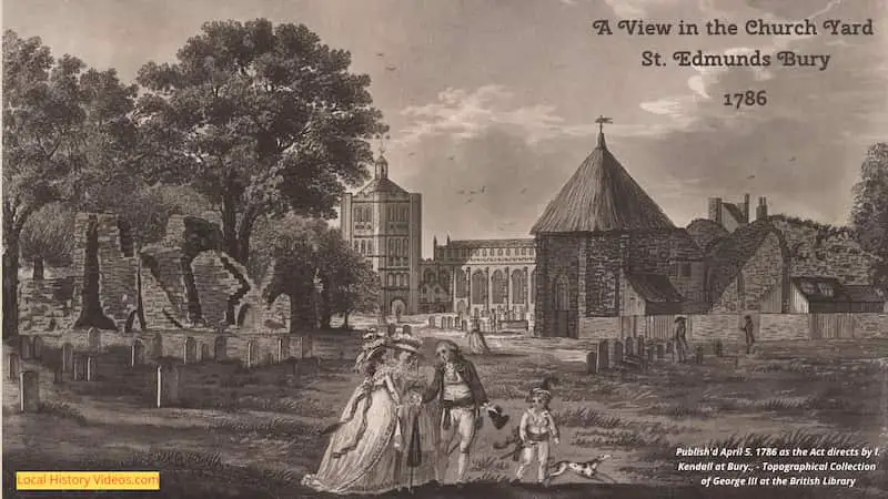
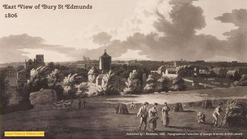
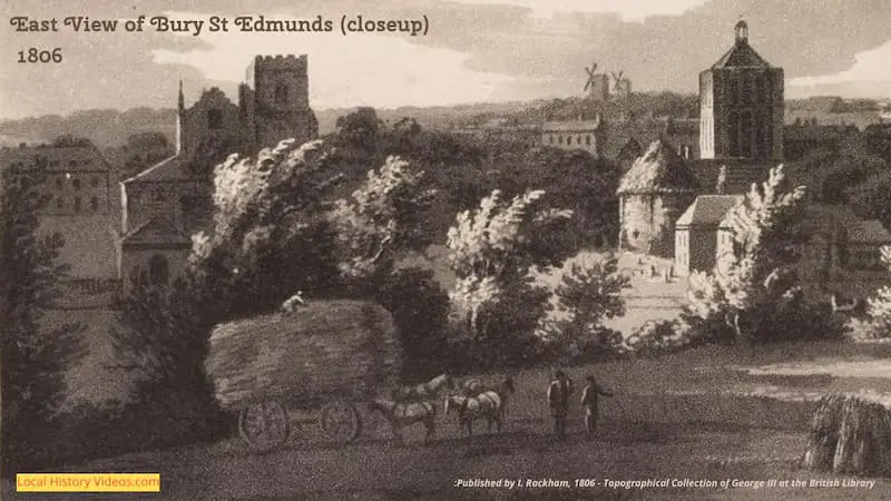
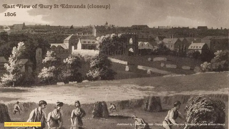
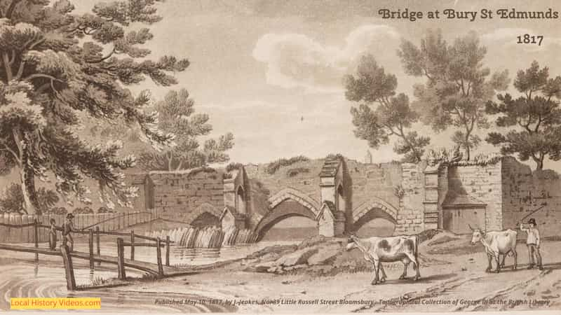
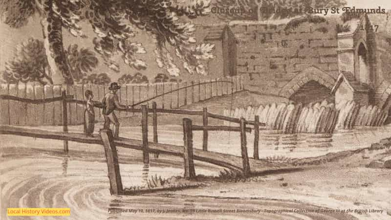
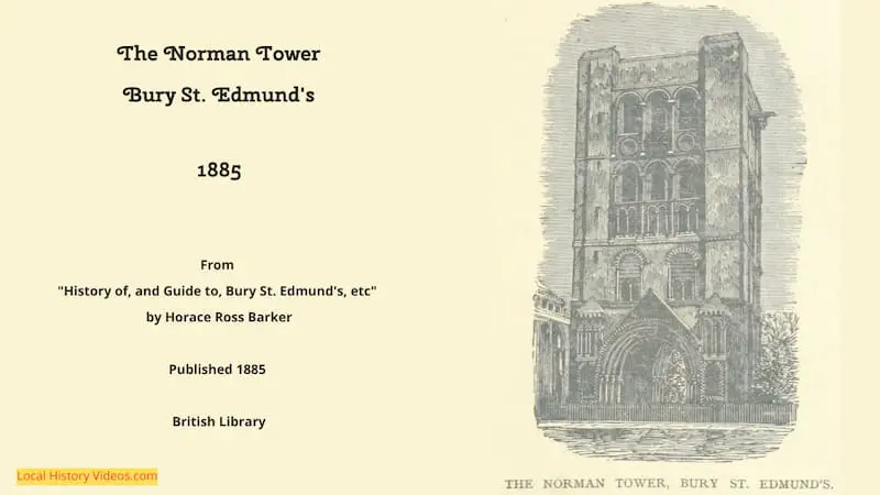
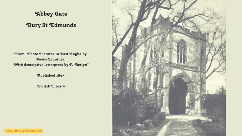
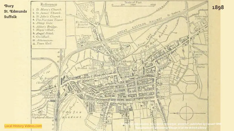
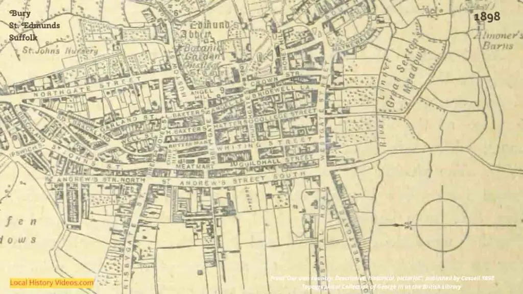
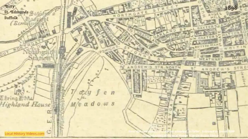
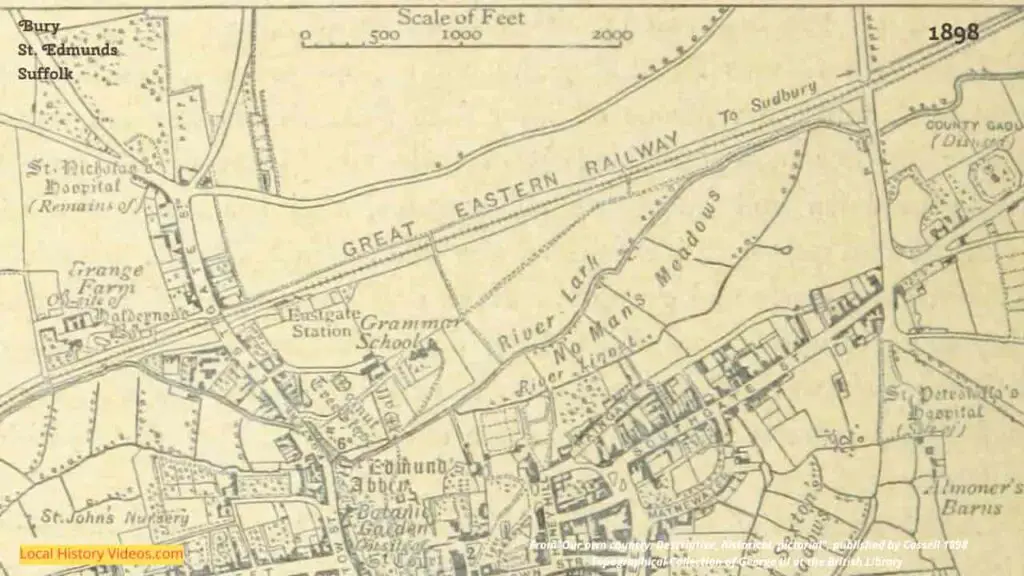
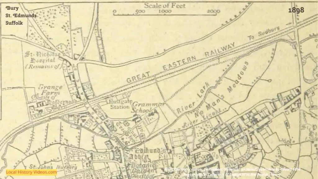
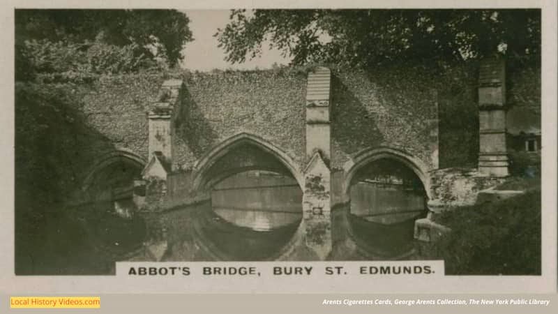
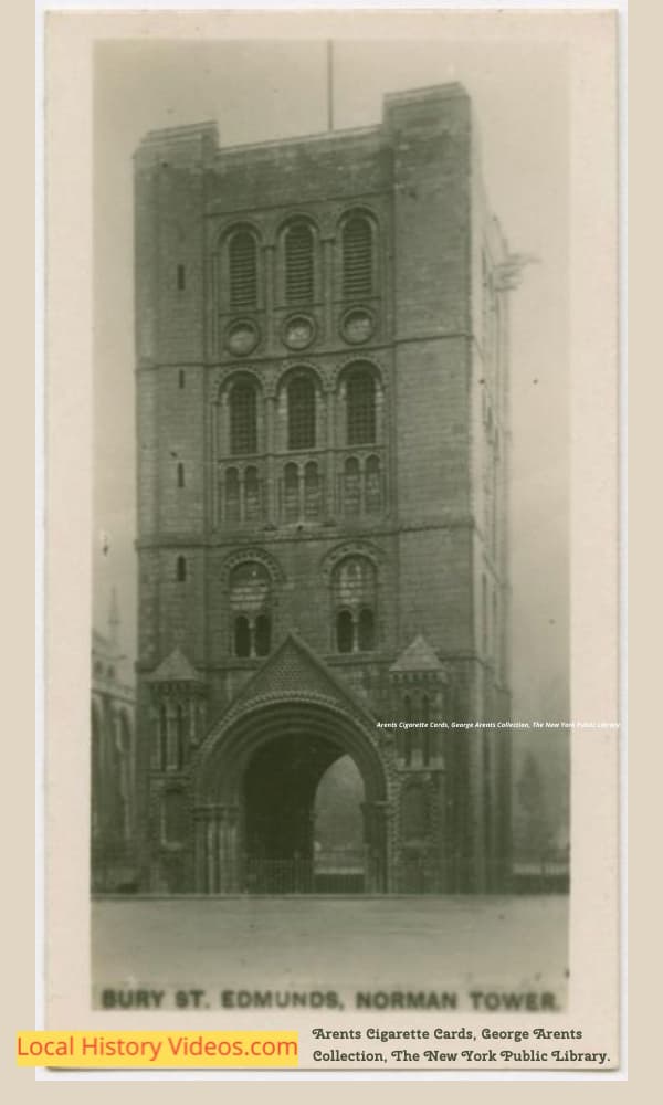
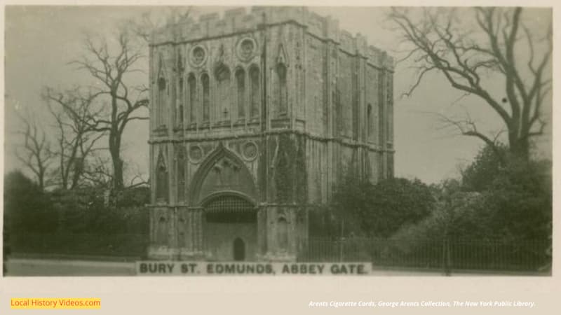
Old picture of Abbey Gate at Bury St Edmunds, published in the 1720s-1730s, and now part of the Topographical Collection of George III at the British LibraryOld picture of St Edmunds Bury from the East, published in 1741, from the Topographical Collection of George III at the British LibraryCloseup of an old picture of St Edmunds Bury from the East, published in 1741, from the Topographical Collection of George III at the British LibraryCloseup of an old picture of St Edmunds Bury from the East, published in 1741, from the Topographical Collection of George III at the British LibraryCloseup of an old picture of St Edmunds Bury from the East, published in 1741, from the Topographical Collection of George III at the British LibraryOld picture of Angel Hill at St Edmund’s Bury, published in 1774; from the Topographical Collection of George III at the British LibraryCloseup of an old picture of Angel Hill at St Edmund’s Bury, published in 1774; from the Topographical Collection of George III at the British LibraryCloseup of an old picture of Angel Hill at St Edmund’s Bury, published in 1774; from the Topographical Collection of George III at the British LibraryCloseup of an old picture of Angel Hill at St Edmund’s Bury, published in 1774; from the Topographical Collection of George III at the British LibraryCloseup of an old picture of Angel Hill at St Edmund’s Bury, published in 1774; from the Topographical Collection of George III at the British LibraryAn old map of St Edmunds Bury, published in 1776, from the Topographical Collection of George III at the British LibraryCloseup of an old map of St Edmunds Bury, published in 1776, from the Topographical Collection of George III at the British LibraryCloseup of an old map of St Edmunds Bury, published in 1776, from the Topographical Collection of George III at the British LibraryCloseup of an old map of St Edmunds Bury, published in 1776, from the Topographical Collection of George III at the British LibraryCloseup of an old map of St Edmunds Bury, published in 1776, from the Topographical Collection of George III at the British LibraryCloseup of an old map of St Edmunds Bury, published in 1776, from the Topographical Collection of George III at the British LibraryOld picture of the Ruins of the Abbey of St Edmund at Bury, published in 1779, part of the Topographical Collection of George III at the British LibraryOld picture of the Ruins of the Abbey of St Edmund at Bury, published in 1779, part of the Topographical Collection of George III at the British LibraryOld picture of the Ruins of the Abbey of St Edmund at Bury, published in 1779, part of the Topographical Collection of George III at the British LibraryCloseup of an old picture of the Ruins of the Abbey of St Edmund at Bury, published in 1779, part of the Topographical Collection of George III at the British LibraryOld picture of horses drinking in the river at the St Edmunds Bury bridge, published in the 1780s, from the Topographical Collection of George III at the British LibraryOld picture of The Churchyard in St Edmunds Bury, published in 1786, in the Topographical Collection of George III at the British LibraryCloseup of an old picture of the East View of Bury St Edmunds, published in 1806, now part of the Topographical Collection of George III at the British LibraryCloseup of an old picture of the East View of Bury St Edmunds, published in 1806, now part of the Topographical Collection of George III at the British LibraryCloseup of an old picture of the East View of Bury St Edmunds, published in 1806, now part of the Topographical Collection of George III at the British LibraryOld picture of the Bridge at Bury St Edmunds, published in 1817, part of the Topographical Collection of George III at the British LibraryCloseup of the old picture of the Bridge at Bury St Edmunds, published in 1817, part of the Topographical Collection of George III at the British LibraryOld picture of the Bridge at Bury St Edmunds, published in 1817, part of the Topographical Collection of George III at the British LibraryOld picture of the Norman Tower in Bury St Edmunds, from “History of, and Guide to, Bury St. Edmund’s etc”, by Horace Ross Barker, published in 1885Old photo of Abbey Gate at Bury St Edmunds, from the book called “Photo Pictures in East Anglia” by Payne Jennings, published 1897Closeup of an old map of Bury St. Edmunds, printed in 1898, in the British Library collectionCloseup of an old map of Bury St. Edmunds, printed in 1898, in the British Library collectionCloseup of an old map of Bury St. Edmunds, printed in 1898, in the British Library collectionCloseup of an old map of Bury St. Edmunds, printed in 1898, in the British Library collectionCloseup of an old map of Bury St. Edmunds, printed in 1898, in the British Library collectionPhoto on an old cigarette card, showing Abbot’s Bridge in Bury St Edmunds; from the New York Public LibraryOld photo on a cigarette card, showing the Norman Tower at Bury St Edmunds, from the New York Public LibraryOld picture on a cigarette card, showing the yard of the Angel Hotel at Bury St Edmunds, from the New York Public LibraryOld photo on a cigarette card, showing Abbey Gate Bury St Edmunds, from the New York Public Library
Time Tour Video
Enjoy watching Bury’s streets stepping back into the past, with the clever use of old images by YouTube’s Time Travel Artist channel.
A Time Tour of Bury St Edmunds: The Time Travel Artist (YouTube)
Enjoy a glimpse of history through old images of Bury St Edmunds, an ancient Suffolk town in England, UK. Old Pictures and Maps of Bury St Edmunds Time Tour Video Enjoy watching Bury’s streets stepping back into the past, with the clever use of old images by YouTube’s Time Travel Artist channel. A Time Tour… Read more: Old Images of Bury St Edmunds, Suffolk
Suffolk is in the region called East of England, which is below Northern England and above the South East region.
About the author
Hi, I’m Debbie. I’ve enjoyed books, films, and documentaries about history for more than 30 years. My favourite trips with friends and family are to museums, historic houses, archaeological sites, and I love unearthing old photos and archive film bringing history to life.


 Glimpse history through old images of Suffolk, England, UK.
 Enjoy a glimpse of history through old images of Bury St Edmunds, an ancient Suffolk town in England, UK. Old Pictures and Maps of Bury St Edmunds Time Tour Video Enjoy watching Bury’s streets stepping back into the past, with the clever use of old images by YouTube’s Time Travel Artist channel. A Time Tour… Read more: Old Images of Bury St Edmunds, Suffolk
 Enjoy a glimpse of history through old images of the seaside town of Lowestoft in the English county of Suffolk, England, UK.
 Glimpse history through old images of Ipswich, Suffolk.
 Suffolk is in the region called East of England, which is below Northern England and above the South East region.