

Enjoy a glimpse of history through old images of Wolverhampton, in the West Midlands, England, UK.
Old Map of Wolverhampton
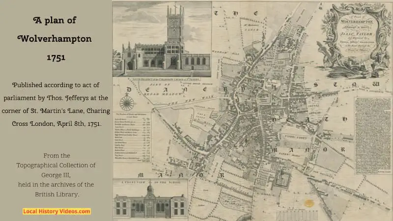
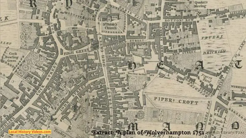
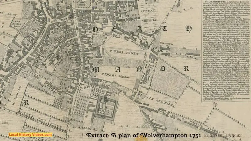
A map of Wolverhampton published in 1751 shows us the locations of pretty formal gardens, orchards and fields, the Workhouse, the Quakers Meeting Rooms.
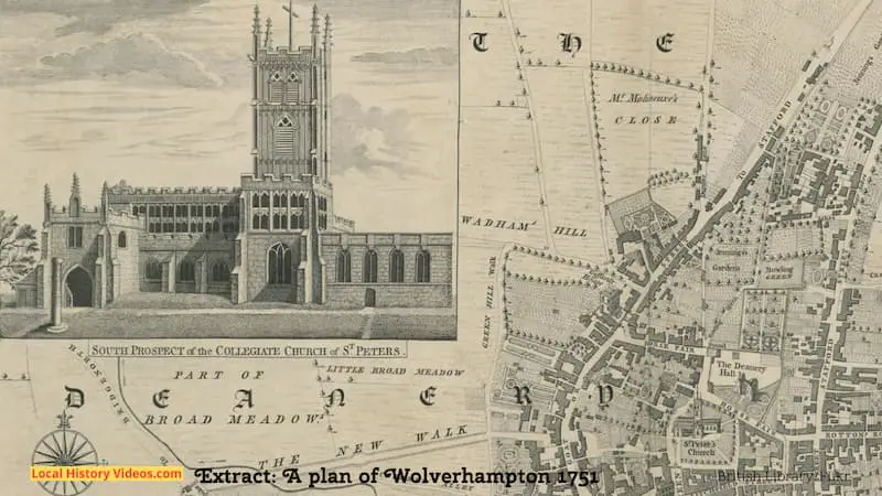
There are also illustrations of St Peter’s Church and the Church.
The historic map above includes a table which is hard to read, so I’ve recreated it here:
Wolverhampton 1751
Belcroft Street
Berry Street Workhouse &c
Boblake & Barns Street
Cock Street
Courts Alleys & Back Buildings
Bilston Street & Manor Lane
High Green & Dudley Sreet
Horse Fair
John Street
Litchfield Street
London Row
New Street
Rottons Row
Stafford Street & Middle Row
Tup Street
Worcester Street & Brickhill Lane
Houses
24
91
180
43
32
114
214
55
66
37
29
14
112
127
209
69
Inhabitants
160
399
888
175
237
784
1032
264
335
228
148
77
527
718
854
428
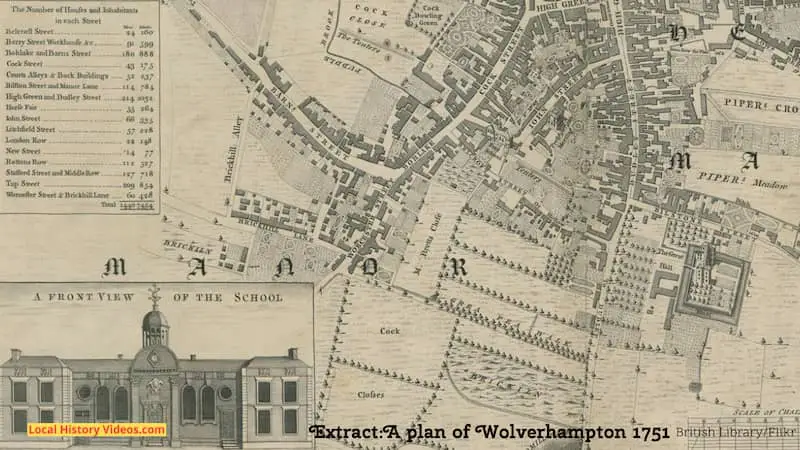
The historic map also includes a paragraph about Wolverhampton in 1751.
It’s too small to read so I’ve written it up here, changing the fs for s, adding punctuation to improve readability, but leaving the old fashioned spelling in place.
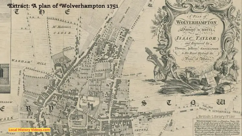
From
“A Plan of Wolverhampton 1751”
Wolverhampton is a populous town situated in the South East part of the County of Stafford, in North Latitude 32, 40 (as is nearly the whole parish except what belongs to the Church in the Manor of Stow Heath, whereof the Right Honorouble John Earl Gower Lord Privy Seal and Thomas Gifford of Chillington Esq, a minor, are joint Lords). And is distant from London 100 Computed and 130 Measured Miles. Its present number of houses are 1,440, and inhabitants 7,454.
This town was first called Hanton by the Saxons from its high situation, then Hamton and Wulfrune’s Hamton, and so Wolverhampton from the Princess Wulfrune its owner, a daughter or sister to King Ethelred who came to the crown in 979.
Here she founded a Collegiate Church for a Dean, and seven Prebedaries. an Official, and other inferior Officers etc. To each of these eight she gave a power over his own lands equal to that of any Lord of the Manor, and to the Dean the same power in spiritual matters as any Bishop enjoyed, making the whole Body and Parish subject to him and him subject to no man’s visitation except that of the King or Lord Keeper of the great Seal. Under him Edward the Confessor made it one of his Royal free Chapels, and Edward IV in 1477 annext the Deanery to that of Windsor.
The present magnificant church except the chancel was built by that great man Hubert Walter, Archbishop of Canterbury, perhaps born here, about the year 1200. He also built proper houses round about it for the Dean and Prebendaries etc, all which are long since gone to ruin. But the Deans was rebuilt by Mr R. Guest; who farmed the Excise of Oliver Cromwell and the Chancel by a voluntary subscription collected by the Reverend Mr. Allenstree since that time.
In 1258 Henry III granted to the Dean a market on Wednesdays and a Fair on the 29th June, the Church being dedicated to St Peter. But tradition says they were granted by King John his father.
The free School was founded by Mr Stephen Jennings born here, who was Lord Mayor of London in 1509, the Government and Choice of the Masters he gave to the Worshipful Company of the Merchant Taylors of which he was a Member. In 1714 they built the present handsome Fabrick for a school and houses for the two Masters.
At present it has 1 Church and 3 Meeting Houses, for Roman Catholicks, Quakers, and Prebyterians, all which will not contain one fifth part of the Inhabitants, a Charity School for 50 boys and 40 girls.
The Iron Manufacture and Toy Trade, in gold, silver, brass, mother of pearl etc are here carryed on as also at Willenhall and Bilston in this Parish after the same manner as at Birmingham, Walsal etc.
King John bestowe the Manor on the Archbishop some time before the Building of St Peter’s Church.
Old Picture of Wolverhampton
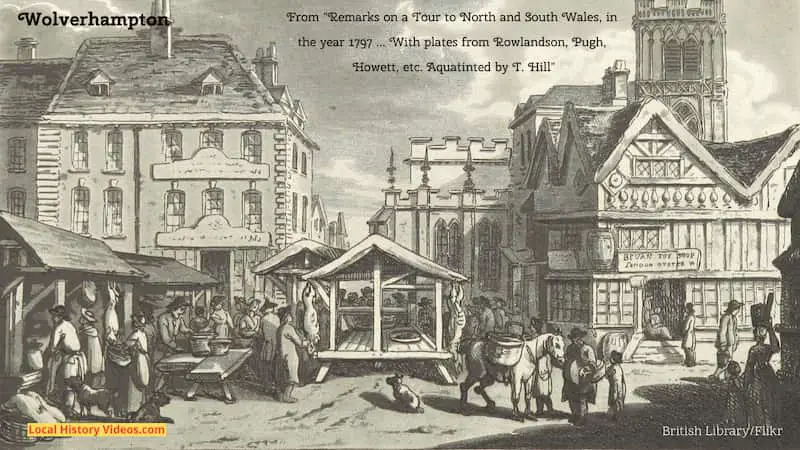
This illustration for a travel book published in 1800 shows Wolverhampton’s busy market square.
The sign above the doorway on the building to the right says “Bevan Toy Shop”, with the words “London Oyster W” underneath.
Unfortunately the two signs on the building to the left show just vague squiggles so we can’t identify the businesses operating there.
As was explained in the extract further up this page, Henry III granted Wolverhampton a charter in 1258 to hold a market on Wednesday each week.
Old Postcards of Wolverhampton
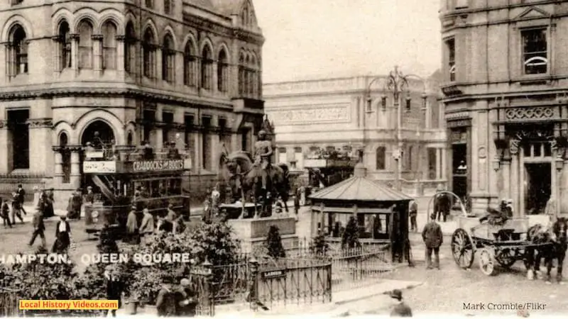
In this first vintage postcard, we see Wolverhampton’s Queen Square at a time when the traffic was made up of horses and trams.
In the foreground is the entrance to the ladies’ underground toilets.
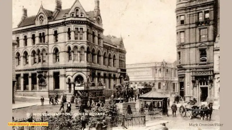
I’ve added a closeup of the same image, so you can see a bit more detail.
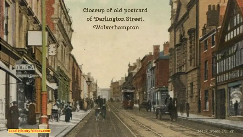
In the second vintage photo postcard, we see trams and horse drawn carts travelling down Darlington Street, Wolverhampton.
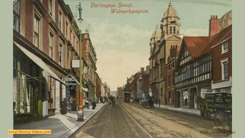
I’ve added a closeup so you can see a bit more of the detail in the image.
Queen Square, Wolverhampton
In the images above we saw an old postcard of Queen Square. Now you can enjoy a video showing how Queen Square changed over the centuries.
James Fox creates brilliant videos taking us back in time using old photos and pictures. He adds location titles and dates, so you know when and when you are.
Wolverhampton Queen’s Square: A Journey Through Time (2017 to 1899): The Time Travel Artist (YouTube)
More Pictures of Old Wolverhampton
If you’re on Pinterest you may be interested in my Pinterest Board showing pictures and vintage photos of Wolverhampton’s past at:
https://www.pinterest.co.uk/LocalHistoryVideos/wolverhampton-old-photos-history
More about the West Midlands
- Old Images of the West Midlands, England
 Glimpse history through old images of the West Midlands, England.
 - Old Images of Wolverhampton, England
 Enjoy a glimpse of history through old images of Wolverhampton, in the West Midlands, England, UK. Old Map of Wolverhampton A map of Wolverhampton published in 1751 shows us the locations of pretty formal gardens, orchards and fields, the Workhouse, the Quakers Meeting Rooms. There are also illustrations of St Peter’s Church and the Church.… Read more: Old Images of Wolverhampton, England
 - Coventry, West Midlands: History in Old IMages
 Enjoy a glimpse of history through old images of Coventry, in the West Midlands, England.
 - Vintage Film & Old Photos Of Birmingham 1950-1989

- West Midlands County, England
 This page and its links are about the ceremonial county of the West Midlands, rather than the larger West Midland’s region.
 - Old Images of Birmingham, West MidlandsEnjoy a glimpse of history through old images of Birmingham, in the West Midlands, England, UK.
Or find more locations on our Sitemap for England