Glimpse history through fascinating old images of Syracuse, New York.
Map of Syracuse 1834
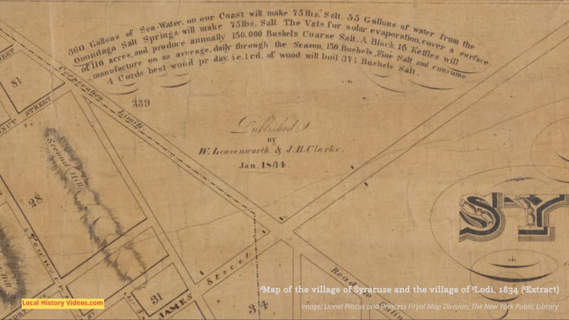
Syracuse and Lodi were still just villages when this map was made in 1834, when the salt industry was still a vital part of the local economy. The rapid development of industry that sprang up around the salty springs along the shoreline of Onondaga Lake in the 18th and 19th centuries had led to the area being nicknamed ‘The Salt City’.
14 years earlier, the area did not have a post office because the settlement did not have a name. Between 1780 and 1817, the community had a succession of names: Salt Point, Webster’s Landing, Bogardus Corners, Milan, South Salina, Cossits’ Corners, and then back to Corinth on the suggestion of Joshua Forman.
However, John Wilkinson’s first post office application was turned down because there was already a Corinth post office in Saratoga County, New York.
John Wilkinson, a lawyer and banker, was reminded of the area’s “salt and freshwater mingling together” when reading a description of Syracuse in Sicily, and his suggestion of Syracuse as a name for their community was readily accepted by both the local residents and the post office officials. Wilkinson became the first postmaster when the post office opened on February 24th, 1820.
The salt industry declined after the American civil war of the 1860s, to be replaced by manufacturing, so this old map captures the settlement at a time before significant changes happened.
I’ve shown an image of the map, and then seven closeups so you can see more of the details.
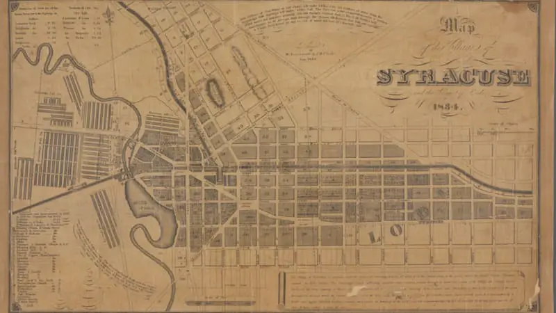
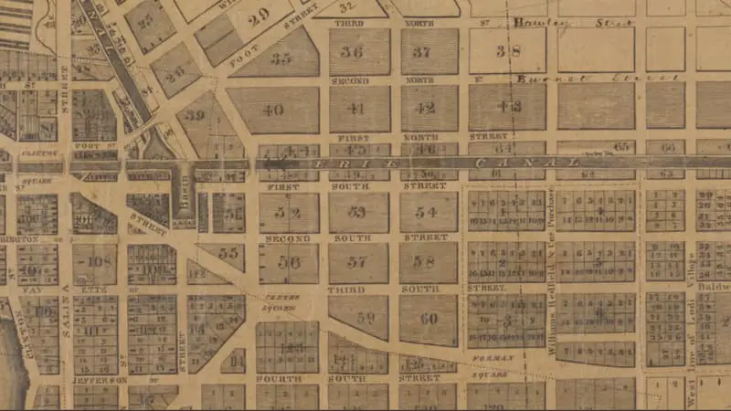
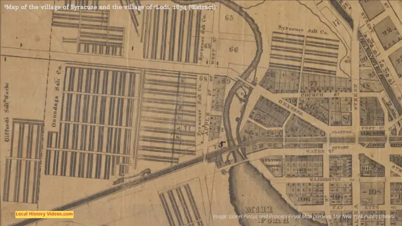
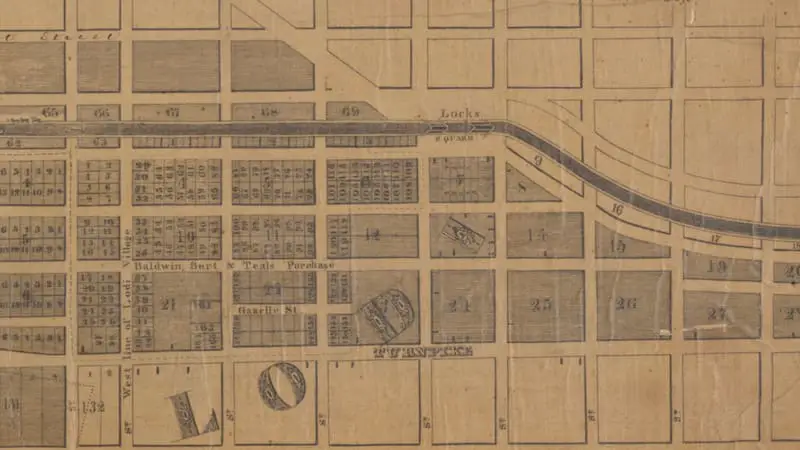
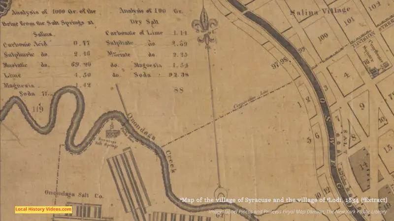
We are told on this map that in 1830 the local population was 2565. It grew by 1,204 people over the next three years, so by the time the map was created in 1834, the population of Syracuse was 3,769.
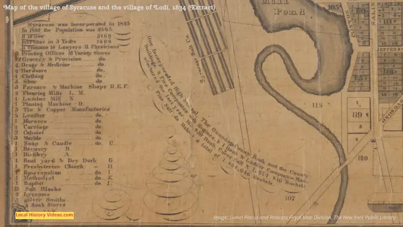
Under this image I have tried to copy what is written, but some of the paper has peeled away so there are blank spaces.
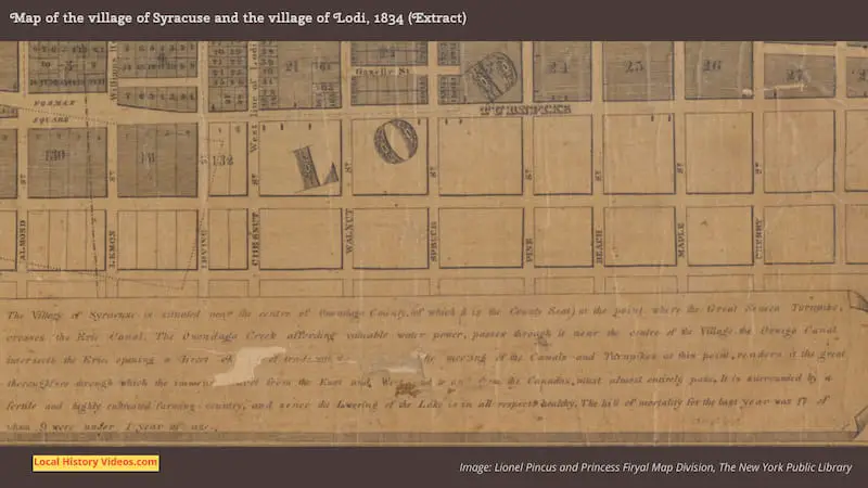
“The Village of Syracuse is situated near the centre of Onondaga County, (of which it is the County Seat) at the point where the Great Seneca Turnpike crosses the Erie Canal. The Onondaga Creek affording valuable water power, passes through it near the centre of the Village. The Oswego Canal intersects the Erie, opening a direct chxxxx of trade with the xxxxthe meeting of the Canals and Turnpikes at this point, renders it the great thoroughfare through which the immense xxxx from the East and West, and to and from the Canadas, must almost entirely pass. It is surrounded by a fertile and highly cultivated farming country, and since the Lowering of the Lake is in all respects healthy . The bill of mortality for the last year was 17 of whom 9 were under 1 year of age.”
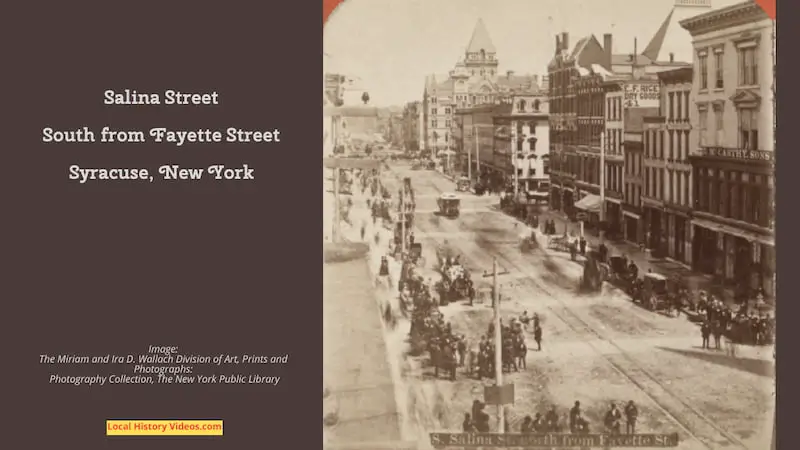
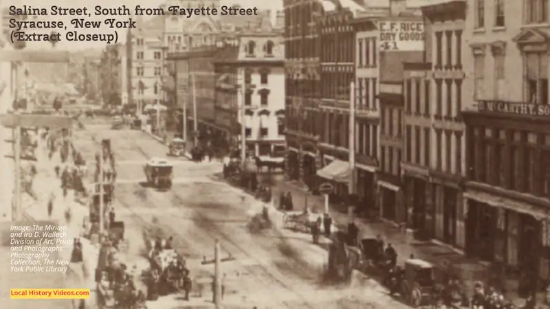
Salina Street
This old photo of Salina Street, looking south from Fayette Street, has so much happening in it that I took a closeup of the line of buildings.
You can see the rails of the streetcar in the road, many horses and carriages, ladies in long skirts, and the telegraph wires along the street.
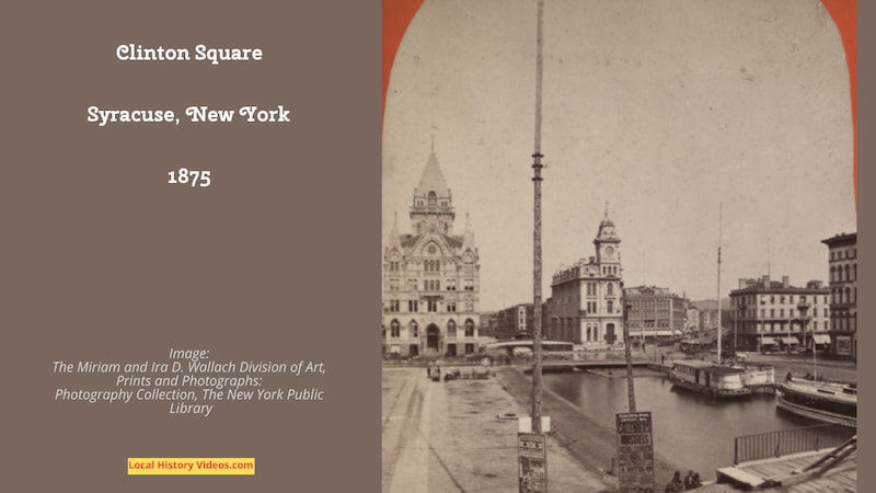
Clinton Square
Two photos from 1875 show the stately and elegant buildings of Clinton Square, the original town center, which thankfully still stand today.
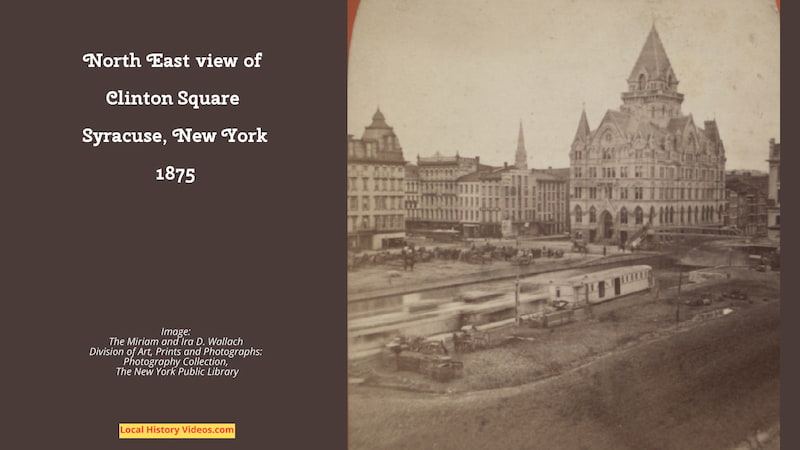
Shakespeare Hall
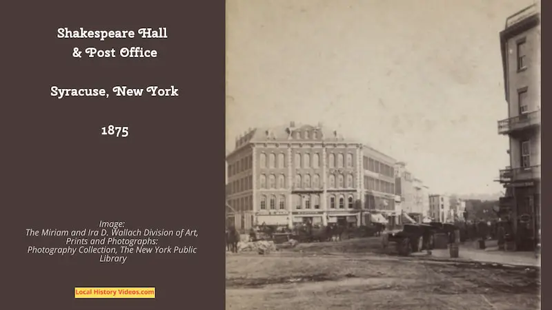
Extract from “A Political History of the State of New York: Volume 3: 1861-1882” by De Alva Stanwood Alexander, published by H. Holt & Company in 1906:
“But whatever the Governor’s motive, Kelly accepted Gumbleton’s removal as an open declaration of war, and on September 6 (1879),five days before the Democratic State convention, Tammany’s committee on organisation secretly declared “that in case the convention insists upo n the renomination of Lucius Robinson for governor, the Tammany delegation will leave in a body.” In preparation for this event an agent of Tammany hired Shakespeare Hall, the only room left in Syracuse of sufficient size to accommodate a bolting convention.”
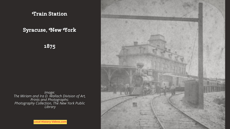
Train Station
The train station shown in this old photo from 1875 is the Delaware, Lackawanna and Western Railroad’s Syracuse station.
The railroad company, incorporated in 1853, had bought the Syracuse, Binghamton and New York Railroad in 1869.
Syracuse 1850-1910
Each image in this showcase of old photos of Syracuse, taken between the years 1850 and 1910, is carefully labelled with the location and date. So you’ll always know when and where you are looking at.
Old photos of Syracuse (N.Y.) 1850-1910 – oldstuff4all on YouTube
The Thruway
In this 13 minute film about building the Thruway, which was made in 1951, there are just a few glimpses of Syracuse.
At 4:33 we are told “Syracuse had done a lot of growing since it was steeled back in 1794. Built on the salt and fur trades, it has become the fourth ranking city in the Empire State. Key to its growth has been its fine transportation facilities, as Syracuse continues to grow in many fields – educational, cultural and industrial, so it must continue to grow in its streets and highways, its transportation system. And this system is growing. Here your department of public works engineers chart the progress of the thruway in the Syracuse area, the finest most ambitious highways project ever undertaken. 535 miles of super highway that will bring all our state within easy reach of Syracuse. Construction is well underway. Out at the old Erie canal locks near Queensboro Bridge you’ll find the new thruway cutting a bigger swath towards Syracuse than the old canal ever dreamed of.”
More street views are seen starting at 8:39, from the downtown traffic queues to the new buildings in the suburbs.
The Thruway would mean an end to traffic jams, safety for the children playing balls games on the streets, and lower prices for transported goods. Well, we can all dream.
The Thruway and Syracuse Tomorrow!, 1951 – New York State Archives on YouTube
St Patrick’s Day Parade 1990
Transferred from VHS tape, this 3 hour programme recorded the St Patick’s Day Parade taking place on a slightly rainy day on March 17th, 1990.
There are several interviews and occasional looks at other local locations, interspersed with commercials broadcast on that day.
Syracuse, NY St. Patrick’s Day Parade – 3/17/90 – Syracuse Nostalgia on YouTube

