Glimpse history through old images of Montpelier, Vermont, the seat of Washington County in the United States of America.
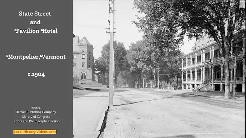
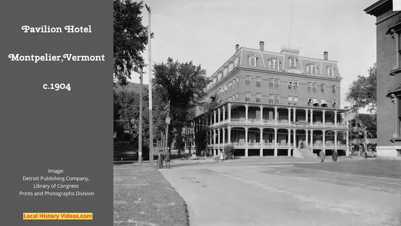
The Pavilion Hotel
At 109 State Street sits a 1971 reconstruction of a French Second Empire style building, now used as the principal workplaces of the Governor of Vermont, the Vermont Attourney General, the Vermont State Treasurer, and the Agency of Administration, as well as the Vermont Historical Society and its museum.
The original hotel on that site was opened in 1808, and later expanded and rebuilt in the Greek Revival style, at which point it became the Pavilion Hotel.
Then in 1874 the building was demolished, to be replaced by the $100,000 French Second Empire style hotel, offering ninety bedrooms, two ball rooms, dining rooms and lounges, all lit by jet gas and served by steam powered elevators.
It served a duel purpose as both a hotel and a home for many of Vermont’s legislators, until October 1966 when longer commuting journeys led to less demand for the hotel’s bedrooms and the premises were abandoned.
Did the Pavilion Hotel need to be demolished in 1969? Probably not, but organised protections for historic buildings were only just emerging. At least the new 1971 building recreated many aspects of the lost building’s facade.
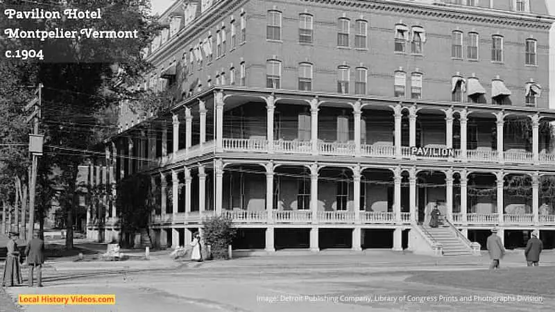
I added this closeup so you can see some of the smaller details in the image:
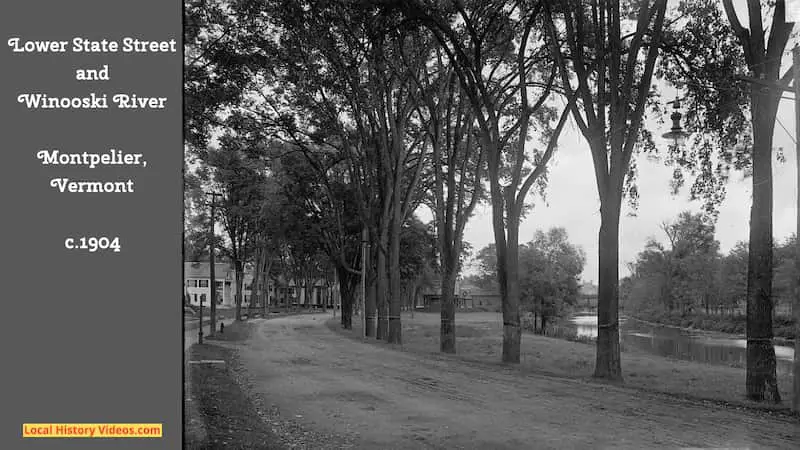
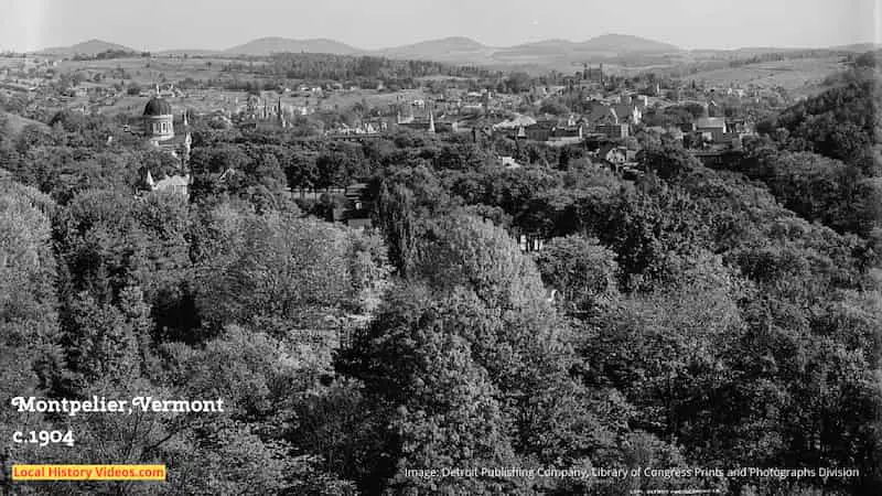
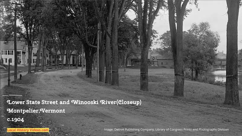
I’ve added a closeup, to give a clearer view of the buildings spotted behind the trees, and the footbridge across the river:
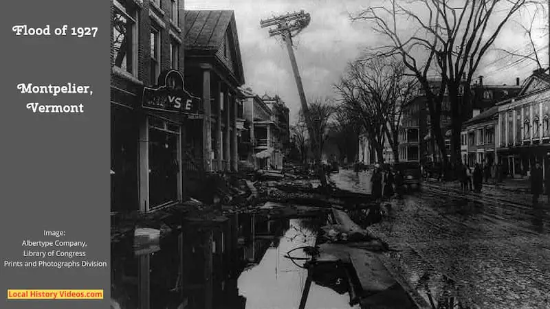
Flood of 1927
This photo is very low resolution so unfortunately I couldn’t add a quality closeup. The Library of Congress site has a handful of 1927 photo thumbails of Montelier’s flooded streets, but they are too small and blurry to display here.
However, even this low resolution photo shows how badly damaged State Street was by Vermont’s great 1927 flood, which happened on 3rd and 4th of November, and left homes abandoned, factories submerged, and farm animals drowned.
On the right side of the photo you can see the Pavilion Hotel.
Montpelier Flood 1992
The news item from 1992 shows how bad that year’s flooding hit Montpelier.
State Street looks like a river, with three to five feet of water flowing fast through the capital building complex. Even the canoe is difficult to keep under control.
Then the ice started to break up and move down the river, which was quite a sight, and there was concern whether the bridges would hold so people weren’t allowed to cross.
Everyone seems very jolly given some of the difficulties they had faced.
Very suddenly, the water disappeared. But of course, that’s when the clean up had to start and the emergency services quickly went round to assess the risks of fire and other dangers.
Montpelier Vermont Flood of 1992 – Ocarina Oftime on YouTube
Montpelier Flood 2011
The serious floods which hit Montpelier on 28th August 2011 following hurricane Irene are shown in this news segment, leading to a discussion and display of old photos of the terrible floods which struck Vermont in 1927.
C-SPAN Cities Tour – Montpelier: Vermont’s Historic Floods – C-SPAN on YouTube
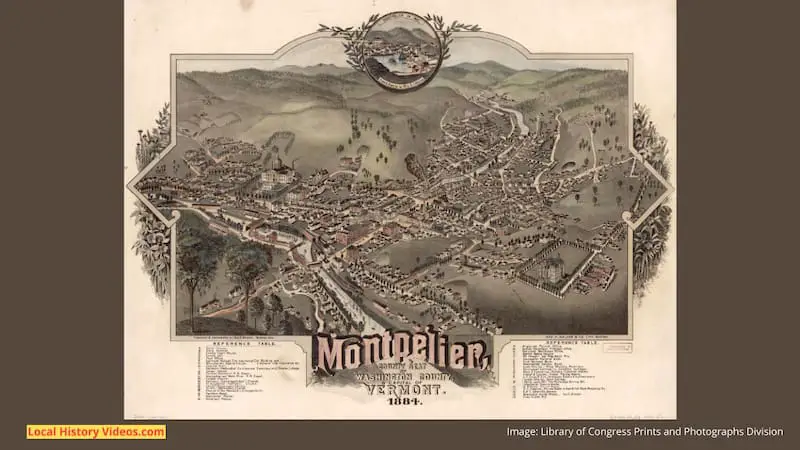
Old Map of Montpelier
Admire a beautifully illustrated old map of Montpelier, created in 1884.
Montpelier Vermont History and Cartograph (1884) – Bravura Media Company on YouTube