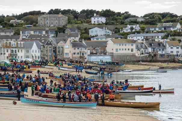
Just over two thousand people (known as ‘Scillonians’) live on the 5 inhabited islands that, along with rocky rocky islets, form the Isles of Scilly.
➡ See The Isles of Scilly In The Old Days
Connection To Cornwall
The Isles of Scilly are part of the ceremonial county of Cornwall, being just 28 miles South West of Cornwall’s Land’s End. However, the majority of local services have been run through the Council of the Isles of Scilly for many decades.
While the majority of residents don’t speak Cornish, it remains a recognised language and many places and houses have Cornish names.
Why Tourism Is A Major Industry Today
Being the southernmost territory of England, the Isles of Scilly benefits from the mildest climate the UK has to offer. It’s thought that the name for the Isles of Scilly derives from Sully, or sunny, reflecting the good weather these Atlantic Ocean islands enjoy. There’s only a 9° variation between the average of the hottest and coldest months.
When you add in the wonderful beaches on offer, it’s easy to see why the ferries maintain a busy trade bringing in visitors through many months of the year.
Harold Wilson was so keen on the climate and walking terrain, in the 1960s he bought a holiday bungalow and was filmed enjoying leisure time with his family in a number of local spots.
A Brief History of The Isles Of Scilly
Standing stones and burial chambers from the Bronze Age have been found on the Isles of Scilly, along with later Roman coins. Hermits, pirates, and then the 12th Century Benedictine monks arrived, and for a while the islands were owned by Tavistock Abbey.
Two centuries later Edward III gave the islands to his son Edward when making the Black Prince the Duke of Cornwall. Much of the freehold land today is still owned by the Duchy of Cornwall, although for more than two centuries the Godolphin family leased the islands under the agreement of Queen Elizabeth I.
Not surprisingly, the granite rocks around the isles were hazardous to shipping. As a result, the end of the 19th century saw the erection of a number of lighthouses. Bishop Rock is where you can still find the UK’s most westerly lighthouse, though only maintenance engineers and their guests can visit, usually by helicopter.
The Settlements of the Isles of Scilly
- Hugh Town, on the Island of St Mary’s (An Nor)
- New Grimsby, on the Isle of Tresco (Treskaw)
- Higher Town, on the Isle of St Martin’s (Breghyek)(with White Island)
- Middle Town, on the Isle of St Agnes (Pennpras) (with Gugh)
- The Town, on the Isle of Bryher (with Gweal)
- Samson, Annet, St Helen’s, Teän, Great Ganilly, a further 45 smaller islets and more than 90 rocks form the uninhabited territory of the Isles of Scilly.
Before 1855 Samson was inhabited, with 36 people living there in 1829. The settlement ruins can still be seen today.
Hugh Town has been the capital of the Scilly Isles since the middle of the 19th century, replacing Old Town which is also on St Mary’s.
Isles Of Scilly Local History Facebook Groups
Facebook Groups are a great way for people to share their memories, photos and family videos with other people who enjoy talking about the area’s past.The Facebook Group we are aware of in connection to the Isles of Scilly is:
- Scilly Now And Then
Isles Of Scilly Local History Resources
There is a long list of national resources you can use for local history research, and many of them include information about the Isles of Scilly. However, the resources that focus on this area include:
- Cornish Forefathers’ Society
- Cornwall Centre (formerly known as the Cornish Studies Library)
- Cornwall Family History Society
- Cornwall Online Census project
- Cornwall Record Office
- Isles of Scilly Community Archaeology Group
- Isles of Scilly Family History Group
- Isles of Scilly Museum
- Penzance Registration District
- Valhalla Museum
Back to Home page.
Thanks to Zichrini for use of the image shown at the top of this page.

